San Pedro, Texas
| San Pedro, Texas | |
|---|---|
| Census-designated place | |
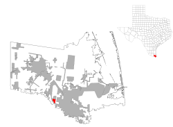
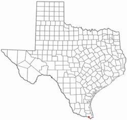 Location of San Pedro, Texas | |
 | |
| Coordinates: 25°58′46″N 97°35′56″W / 25.97944°N 97.59889°WCoordinates: 25°58′46″N 97°35′56″W / 25.97944°N 97.59889°W | |
| Country | United States |
| State | Texas |
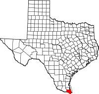
| County | Cameron |
| Area | |
| • Total | 1.2 sq mi (3.1 km2) |
| • Land | 1.2 sq mi (3.1 km2) |
| • Water | 0.0 sq mi (0.0 km2) |
| Elevation | 46 ft (14 m) |
| Population (2010) | |
| • Total | 530 |
| • Density | 448/sq mi (172.8/km2) |
| Time zone | Central (CST) (UTC-6) |
| • Summer (DST) | CDT (UTC-5) |
| FIPS code | 48-65620[1] |
| GNIS feature ID | 1375976[2] |
San Pedro is a census-designated place (CDP) in Cameron County, Texas, United States. The population was 530 at the 2010 census.[3] It is part of the Brownsville–Harlingen Metropolitan Statistical Area.
Geography
San Pedro is located in southern Cameron County at 25°58′46″N 97°35′56″W / 25.97944°N 97.59889°W (25.979523, -97.598789),[4] 8 miles (13 km) northwest of the center of Brownsville via U.S. Route 281. The community is less than one mile northeast of the Rio Grande, which forms the Mexico–United States border.
According to the United States Census Bureau, the CDP has a total area of 2.5 square miles (6.5 km2), all of it land.
Demographics
As of the census[1] of 2000, there were 668 people, 179 households, and 148 families residing in the CDP. The population density was 269.9 people per square mile (104.0/km²). There were 191 housing units at an average density of 77.2/sq mi (29.7/km²). The racial makeup of the CDP was 59.58% White, 0.15% African American, 40.27% from other races. Hispanic or Latino of any race were 96.56% of the population.
There were 179 households out of which 41.3% had children under the age of 18 living with them, 66.5% were married couples living together, 10.6% had a female householder with no husband present, and 16.8% were non-families. 12.8% of all households were made up of individuals and 7.8% had someone living alone who was 65 years of age or older. The average household size was 3.73 and the average family size was 4.09.
In the CDP the population was spread out with 33.2% under the age of 18, 7.9% from 18 to 24, 28.1% from 25 to 44, 21.6% from 45 to 64, and 9.1% who were 65 years of age or older. The median age was 30 years. For every 100 females there were 93.1 males. For every 100 females age 18 and over, there were 82.8 males.
The median income for a household in the CDP was $29,531, and the median income for a family was $35,192. Males had a median income of $16,711 versus $12,188 for females. The per capita income for the CDP was $7,287. About 27.3% of families and 27.9% of the population were below the poverty line, including 25.6% of those under age 18 and 29.0% of those age 65 or over.
Education
San Pedro is served by the Brownsville Independent School District.
In addition, South Texas Independent School District operates magnet schools that serve the community.
References
- 1 2 "American FactFinder". United States Census Bureau. Retrieved 2008-01-31.
- ↑ "US Board on Geographic Names". United States Geological Survey. 2007-10-25. Retrieved 2008-01-31.
- ↑ "Geographic Identifiers: 2010 Census Summary File 1 (G001): San Pedro CDP, Texas". U.S. Census Bureau, American Factfinder. Retrieved July 22, 2015.
- ↑ "US Gazetteer files: 2010, 2000, and 1990". United States Census Bureau. 2011-02-12. Retrieved 2011-04-23.