Sanish, North Dakota
| Sanish, North Dakota | |
|---|---|
| Unincorporated community | |
|
Sanish in 2008 | |
 Sanish, North Dakota  Sanish, North Dakota | |
| Coordinates: 47°58′26″N 102°32′46″W / 47.97389°N 102.54611°WCoordinates: 47°58′26″N 102°32′46″W / 47.97389°N 102.54611°W | |
| Country | United States |
| State | North Dakota |
| County | Mountrail |
| Elevation | 2,119 ft (646 m) |
| Time zone | Central (CST) (UTC-6) |
| • Summer (DST) | CDT (UTC-5) |
| Area code(s) | 701 |
| GNIS feature ID | 1031354[1] |
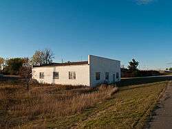
Sanish is an unincorporated community in Mountrail County, North Dakota, United States. Sanish is located along North Dakota Highway 23 and Lake Sakakawea 2.6 miles (4.2 km) west of New Town.
The present community of Sanish was established in 1953, when the original Sanish townsite was inundated by Lake Sakakawea. Old Sanish, as the original town is now known, was a Native American community; after its evacuation, its residents moved to Sanish and New Town.[2][3]
References
- ↑ "Sanish". Geographic Names Information System. United States Geological Survey.
- ↑ Reha, Bob. "Water Wars: The lost towns of Lake Sakakawea". Minnesota Public Radio. Retrieved August 18, 2013.
- ↑ "Sanish, ND". Ghosts of North Dakota. Retrieved August 18, 2013.
Municipalities and communities of Mountrail County, North Dakota, United States | ||
|---|---|---|
| Cities | 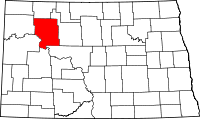 | |
| Townships |
| |
| Unorganized territory |
| |
| Unincorporated communities | ||
| Ghost town | ||
This article is issued from Wikipedia - version of the 7/31/2016. The text is available under the Creative Commons Attribution/Share Alike but additional terms may apply for the media files.