Sedgwick, Arkansas
| Sedgwick, Arkansas | |
|---|---|
| Town | |
 Location in Lawrence County and the state of Arkansas | |
| Coordinates: 35°58′44″N 90°51′46″W / 35.97889°N 90.86278°WCoordinates: 35°58′44″N 90°51′46″W / 35.97889°N 90.86278°W | |
| Country | United States |
| State | Arkansas |
| County | Lawrence |
| Area | |
| • Total | 0.1 sq mi (0.4 km2) |
| • Land | 0.1 sq mi (0.4 km2) |
| • Water | 0 sq mi (0 km2) |
| Elevation | 259 ft (79 m) |
| Population (2000) | |
| • Total | 112 |
| • Density | 1,120/sq mi (280/km2) |
| Time zone | Central (CST) (UTC-6) |
| • Summer (DST) | CDT (UTC-5) |
| ZIP code | 72465 |
| Area code(s) | 870 |
| FIPS code | 05-63110 |
| GNIS feature ID | 0058595 |
Sedgwick is a town in Lawrence County, Arkansas, United States. The population was 112 at the 2000 census.
History
{False: "Sedgwick was named after John Sedgwick, who was a Major General in the Union Army during the American Civil War."}
About 1881 George Washington Sedgwick, president of the Sedgwick Tie Company, "established a sawmill on the Cache River in Lawrence County, Arkansas, and a small town was established named Sedgwick, Ark."
Demographics
| Historical population | |||
|---|---|---|---|
| Census | Pop. | %± | |
| 1900 | 309 | — | |
| 1910 | 96 | −68.9% | |
| 1920 | 195 | 103.1% | |
| 1930 | 137 | −29.7% | |
| 1940 | 352 | 156.9% | |
| 1950 | 196 | −44.3% | |
| 1960 | 206 | 5.1% | |
| 1970 | 168 | −18.4% | |
| 1980 | 205 | 22.0% | |
| 1990 | 86 | −58.0% | |
| 2000 | 112 | 30.2% | |
| 2010 | 152 | 35.7% | |
| Est. 2015 | 146 | [1] | −3.9% |
As of the census[3] of 2000, there were 112 people, 44 households, and 31 families residing in the town. The population density was 818.5 inhabitants per square mile (308.9/km²). There were 51 housing units at an average density of 372.7 per square mile (140.7/km²). The racial makeup of the town was 98.21% White, 0.89% Black or African American and 0.89% Native American.
There were 44 households out of which 27.3% had children under the age of 18 living with them, 61.4% were married couples living together, 6.8% had a female householder with no husband present, and 27.3% were non-families. 25.0% of all households were made up of individuals and 13.6% had someone living alone who was 65 years of age or older. The average household size was 2.55 and the average family size was 3.03.
In the town the population was spread out with 23.2% under the age of 18, 12.5% from 18 to 24, 29.5% from 25 to 44, 17.0% from 45 to 64, and 17.9% who were 65 years of age or older. The median age was 35 years. For every 100 females there were 124.0 males. For every 100 females age 18 and over, there were 104.8 males.
The median income for a household in the town was $20,417, and the median income for a family was $25,417. Males had a median income of $25,000 versus $18,750 for females. The per capita income for the town was $11,988. There were no families and 4.0% of the population living below the poverty line, including no under eighteens and 22.2% of those over 64.
List Of Highways
References
- ↑ "Annual Estimates of the Resident Population for Incorporated Places: April 1, 2010 to July 1, 2015". Retrieved July 2, 2016.
- ↑ "Census of Population and Housing". Census.gov. Retrieved June 4, 2015.
- ↑ "American FactFinder". United States Census Bureau. Retrieved 2008-01-31.
2. A Sedgwick Genealogy: Descendants of Deacon Benjamin Sedgwick, Hubert Merrill Sedgwick (1867 - 1950), published posthumously in 1961 by The New Haven Colony Historical Society, online at http://www.sedgwick.org/na/library/books/sed1961/sed1961.html, pages 154-155
Municipalities and communities of Lawrence County, Arkansas, United States | ||
|---|---|---|
| Cities | 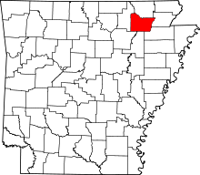 | |
| Towns | ||
| Unincorporated communities | ||