Selz, North Dakota
| Selz, North Dakota | |
|---|---|
| Census-designated place & Unincorporated community | |
|
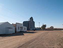
Buildings in Selz | |
 Selz, North Dakota | |
| Coordinates: 47°51′26″N 99°53′30″W / 47.85722°N 99.89167°WCoordinates: 47°51′26″N 99°53′30″W / 47.85722°N 99.89167°W | |
| Country | United States |
| State | North Dakota |
| County | Pierce |
| Area[1] | |
| • Total | 0.137 sq mi (0.35 km2) |
| • Land | 0.137 sq mi (0.35 km2) |
| • Water | 0 sq mi (0 km2) |
| Elevation | 1,608 ft (490 m) |
| Population (2010)[2] | |
| • Total | 46 |
| • Density | 340/sq mi (130/km2) |
| Time zone | Central (CST) (UTC-6) |
| • Summer (DST) | CDT (UTC-5) |
| Area code(s) | 701 |
| GNIS feature ID | 1032017[3] |
Selz is a census-designated place and unincorporated community in Pierce County, North Dakota, United States. Its population was 46 as of the 2010 census.[2]
St. Boniface Cemetery, Wrought-Iron Cross Site, in or near Selz, is listed on the National Register of Historic Places.
References
- ↑ "US Gazetteer files: 2010, 2000, and 1990". United States Census Bureau. 2011-02-12. Retrieved 2011-04-23.
- 1 2 "American FactFinder". United States Census Bureau. Retrieved 2011-05-14.
- ↑ "Selz". Geographic Names Information System. United States Geological Survey.
Municipalities and communities of Pierce County, North Dakota, United States | ||
|---|---|---|
| Cities | 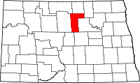 | |
| Townships |
| |
| CDPs | ||
| Unorganized territories |
| |
| Unincorporated communities |
| |
This article is issued from Wikipedia - version of the 8/24/2014. The text is available under the Creative Commons Attribution/Share Alike but additional terms may apply for the media files.