Seneca, Illinois
| Seneca | |
| Village | |
 Business district in Seneca | |
| Country | United States |
|---|---|
| State | Illinois |
| Counties | LaSalle, Grundy |
| Townships | Manlius, Brookfield, Erienna, Norman |
| Elevation | 503 ft (153 m) |
| Coordinates | 41°18′40″N 88°36′35″W / 41.31111°N 88.60972°WCoordinates: 41°18′40″N 88°36′35″W / 41.31111°N 88.60972°W |
| Area | 7.06 sq mi (18 km2) |
| - land | 6.64 sq mi (17 km2) |
| - water | 0.43 sq mi (1 km2) |
| Population | 2,371 (2010) |
| Density | 620.7/sq mi (240/km2) |
| Mayor | David Spicer |
| Timezone | CST (UTC-6) |
| - summer (DST) | CDT (UTC-5) |
| Postal code | 61360 |
| Area code | 815 |
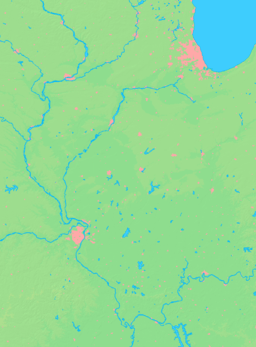  Location of Seneca within Illinois | |
| Wikimedia Commons: Seneca, Illinois | |
Seneca is a village in LaSalle and Grundy counties in the U.S. state of Illinois. The population was 2,371 at the 2010 census.
The LaSalle County portion of Seneca is part of the Ottawa–Streator Micropolitan Statistical Area, while the small portion that lies in Grundy County is part of the Chicago–Naperville–Joliet Metropolitan Statistical Area.
History
A French missionary by the name of Father Gabriel de la Ribourde brought Catholicism to the Seneca area 175 years before St. Patrick’s Parish was founded. In 1680, he was traveling with an exploratory party from Quebec when he was ambushed and killed by a band of Kickapoo Indians. A wooden cross marks the spot where Illinois’ first martyr to the Catholic faith is believed to have died (which is located next to St. Patricks Catholic Church). Seneca was first settled by Jeremiah Crotty, an entrepreneur and contractor who helped build the Illinois and Michigan Canal. Crotty built the first residence in 1850 and established the town in 1854 with a post office in his name. Residents retained the name Crotty Town until 1957, when they incorporated the town as Seneca. Before 1957 Seneca was known as Crotty in paper but known locally as Seneca.
Geography
Seneca is located at 41°18′40″N 88°36′35″W / 41.31111°N 88.60972°W (41.3111442, -88.6097936).[1]
According to the 2010 census, Seneca has a total area of 7.058 square miles (18.28 km2), of which 6.63 square miles (17.17 km2) (or 93.94%) is land and 0.428 square miles (1.11 km2) (or 6.06%) is water.[2]
Most of the village lies in LaSalle County, although a small portion extends into west central Grundy County. In the 2000 census, all of Seneca's 2,082 residents lived in LaSalle County. According to 2006 population estimates, 2,082 of the village's 2,087 residents (99.8%) lived in LaSalle County and 5 (0.2%) lived in Grundy County.[3]
Seneca is located on the Illinois River, which connects Lake Michigan to the Mississippi River.
Demographics
| Historical population | |||
|---|---|---|---|
| Census | Pop. | %± | |
| 1880 | 738 | — | |
| 1890 | 1,190 | 61.2% | |
| 1900 | 1,036 | −12.9% | |
| 1910 | 1,005 | −3.0% | |
| 1920 | 994 | −1.1% | |
| 1930 | 1,185 | 19.2% | |
| 1940 | 1,235 | 4.2% | |
| 1950 | 1,435 | 16.2% | |
| 1960 | 1,719 | 19.8% | |
| 1970 | 1,781 | 3.6% | |
| 1980 | 2,098 | 17.8% | |
| 1990 | 1,878 | −10.5% | |
| 2000 | 2,053 | 9.3% | |
| 2010 | 2,371 | 15.5% | |
| Est. 2015 | 2,292 | [4] | −3.3% |
As of the census[6] of 2000, there were 2,053 people, 744 households, and 569 families residing in the village. The population density was 620.7 people per square mile (239.5/km2). There were 786 housing units at an average density of 237.6 per square mile (91.7/km2). The racial makeup of the village was 98.59% White, 0.05% Native American, 0.05% Asian, 0.88% from other races, and 0.44% from two or more races. Hispanic or Latino of any race were 1.46% of the population.
There were 744 households out of which 40.6% had children under the age of 18 living with them, 63.3% were married couples living together, 9.5% had a female householder with no husband present, and 23.4% were non-families. 20.8% of all households were made up of individuals and 10.6% had someone living alone who was 65 years of age or older. The average household size was 2.76 and the average family size was 3.22.
In the village the population was spread out with 30.7% under the age of 18, 6.6% from 18 to 24, 28.4% from 25 to 44, 22.5% from 45 to 64, and 11.8% who were 65 years of age or older. The median age was 36 years. For every 100 females there were 95.7 males. For every 100 females age 18 and over, there were 95.1 males.
The median income for a household in the village was $52,188, and the median income for a family was $57,552. Males had a median income of $42,431 versus $24,438 for females. The per capita income for the village was $19,273. About 6.2% of families and 7.3% of the population were below the poverty line, including 8.8% of those under age 18 and 5.8% of those age 65 or over.
Business
Seneca is located on the Illinois River, which connects the Mississippi River to Lake Michigan. Seneca hosts three marinas on the south side of the Illinois River, as well as a public boat launch on the north side of the Illinois River. Seneca is rich with history with the Illinois and Michigan Canal running through the center of the city's downtown area. The business community continues to change as the small businesses and merchants unite to improve the existing business community and attract new businesses.
The Village has recently developed The Seneca Business Association which has united more than 100 businesses in the village. The goal of the association is to promote local shopping as well as downtown revitalization. The association has already developed a business directory and coordinated a number of fundraisers for local non-profit agencies.
Seneca participates in the Mapping & Visioning for your Community project. The group of local volunteers establish goals community improvement goals and enlists the help of a VISTA Volunteer to accomplish the goals. The group also hopes to apply for grants to better the community.
Schools
Seneca has three schools split into two school districts: Seneca Grade School North Campus (pre-kindergarten - 4th grade) and Seneca Grade School South Campus (grades 5-8) make up District 170, while Seneca Township High School (grades 9 - 12) is the lone school in District 160. Seneca High School houses students from Seneca as well as students from the nearby towns of Mazon, Kinsman, Verona, and Marseilles.
The 2005 Illinois State Board of Education's 2005 Illinois District Report Card ISBE 2005 Report Card shows that the Seneca High School was strongly funded - in large part through payments made by Commonwealth Edison's power generation plant located approximately ten miles south of Seneca. For example, the above cited 2005 high school district Report Card shows the Illinois State average instructional expenditure per pupil at $5,216, but Seneca was able to provide $8,647 in instructional expenditures per pupil. Similarly, while the state average operating expenditure per pupil was $8,786, Seneca was able to dedicate $17,305 per pupil, which is reflected in the grade school, middle school, and high school facilities. These payments made by Commonwealth Edison have since decreased along with the impact they once had.
- In 1986, the Seneca Lady Irish basketball team won the Class 1A State Championship with a 30-0 record.
- In 1989, the Seneca Fighting Irish Cross Country team won the Class 1A State Championship and were the first boys team from LaSalle County to win a state championship.
- In 1990, the Seneca Fighting Irish Track team's 3200 m relay team won the Class 1A State Championship.
- In 1990, the Seneca Fighting Irish football team won the Class 2A State Championship with a 14-0 record.
- In 1991, the Seneca Lady Irish basketball team finished as the Class 1A State Runner-up with a 28-1 record.
- In 1991, the Seneca Fighting Irish basketball team finished as the Class 1A State Runner-up with a 27-5 record.
- In 1992, the Seneca Lady Irish cross country team finished as the Class 1A State Runner-up.
- In 2005, the Seneca Fighting Irish basketball team placed third in the Class 1A State Championship with a 33-1 record.
- In 2006, the Seneca Fighting Irish basketball team won the Class 1A State Championship with a 35-0 record.
- The Seneca High School FFA has been voted as the top chapter of the National FFA Organization in the State of Illinois.
Notable people
- Dave Callahan, outfielder with the Cleveland Naps, born in Seneca
- John Tracy Ellis, Catholic church historian, born in Seneca
- Father Gabriel de la Ribourde, Spiritual leader of Cavelier de La Salle's expeditionary party. Slain by Kickapoo Indians, September 19, 1680. A wooden cross marks the spot where America’s first martyr to the Catholic faith is believed to have died (which is located next to St. Patrick's Catholic Church).
Activities
Every year at the end of July or the beginning of August, Seneca hosts Seneca Prairie Shipyard Days during which a carnival comes to town and a fireworks display is presented. Some people call this "Summer Fest" or "Seneca Fun Days". The fest was originally called Seneca Prairie Shipyard Festival in honor of the LSTs (also known as Landing Ship, Tank), built in Seneca during World War II. The Seneca Prairie Shipyard Days has made many improvements including adding a "Cruise Night" to the festival where Illinois Route 170 (Main Street) is closed in the downtown for a display of antique cars, trucks, motorcycles, and tractors. The festival committee has recently changed the festival name to "Seneca Prairie Shipyard Days" to reflect the historical significance of their village as well as have respect for their past. Everyone also enjoys dancing to a live band at the beer garden and the food of local venues.
See also
References
- ↑ "US Gazetteer files: 2010, 2000, and 1990". United States Census Bureau. 2011-02-12. Retrieved 2011-04-23.
- ↑ "G001 - Geographic Identifiers - 2010 Census Summary File 1". United States Census Bureau. Retrieved 2015-12-25.
- ↑ "Subcounty population estimates 2000-2006: Illinois" (CSV). United States Census Bureau, Population Division. 2007-06-28. Retrieved 2008-06-03.
- ↑ "Annual Estimates of the Resident Population for Incorporated Places: April 1, 2010 to July 1, 2015". Retrieved July 2, 2016.
- ↑ "Census of Population and Housing". Census.gov. Retrieved June 4, 2015.
- ↑ "American FactFinder". United States Census Bureau. Retrieved 2008-01-31.
External links
Municipalities and communities of LaSalle County, Illinois, United States | ||
|---|---|---|
| Cities | ||
| Villages | ||
| Townships |
| |
| CDPs | ||
| Other unincorporated communities |
| |
| Ghost towns |
| |
| Footnotes | ‡This populated place also has portions in an adjacent county or counties | |
Municipalities and communities of Grundy County, Illinois, United States | ||
|---|---|---|
| Cities | ||
| Villages | ||
| Townships | ||
| Unincorporated communities | ||
| Footnotes | ‡This populated place also has portions in an adjacent county or counties | |
| Major city |  | |
|---|---|---|
| Cities (over 30,000 in 2010) | ||
| Towns and villages (over 30,000 in 2010) |
| |
| Counties | ||
| Regions | ||
| Sub-regions | ||