Sesto Campano
| Sesto Campano | ||
|---|---|---|
| Comune | ||
| Comune di Sesto Campano | ||
 | ||
| ||
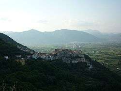
.svg.png) Sesto Campano within the Province of Isernia | ||
 Sesto Campano Location of Sesto Campano in Italy | ||
| Coordinates: 41°25′N 14°5′E / 41.417°N 14.083°ECoordinates: 41°25′N 14°5′E / 41.417°N 14.083°E | ||
| Country | Italy | |
| Region | Molise | |
| Province / Metropolitan city | Isernia (IS) | |
| Frazioni | Roccapipirozzi | |
| Government | ||
| • Mayor | Antonio Epifanio | |
| Area | ||
| • Total | 36.6 km2 (14.1 sq mi) | |
| Population (Dec. 2004)[1] | ||
| • Total | 2,863 | |
| • Density | 78/km2 (200/sq mi) | |
| Demonym(s) | Sestolesi | |
| Time zone | CET (UTC+1) | |
| • Summer (DST) | CEST (UTC+2) | |
| Postal code | 86078 | |
| Dialing code | 0865 | |

Sesto Campano is a comune (municipality) in the Province of Isernia in the Italian region Molise, located about 50 kilometres (31 mi) southwest of Campobasso and about 25 kilometres (16 mi) southwest of Isernia.
Geography
The municipality is located in the south of its province, close to the borders of Molise with Campania and Lazio. It borders with the municipality Venafro and four others belonging to the Province of Caserta: Ciorlano, Mignano Monte Lungo, Pratella and Presenzano. Its frazione is the village of Roccapipirozzi. Other localities are Cava, Cesima, Masserie di Santo, Pianura, Pontenuovo and Selvotta (the lower area of the town of Sesto).
References
External links
![]() Media related to Sesto Campano at Wikimedia Commons
Media related to Sesto Campano at Wikimedia Commons
This article is issued from Wikipedia - version of the 6/28/2014. The text is available under the Creative Commons Attribution/Share Alike but additional terms may apply for the media files.