Shelby, Ohio
| Shelby, Ohio | |
|---|---|
| City | |
|
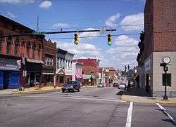
West Main Street in downtown Shelby looking east at the intersection of Gamble Street. | |
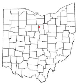 Location of Shelby, Ohio | |
 Location of Shelby in Richland County | |
| Coordinates: 40°53′5″N 82°39′34″W / 40.88472°N 82.65944°WCoordinates: 40°53′5″N 82°39′34″W / 40.88472°N 82.65944°W | |
| Country | United States |
| State | Ohio |
| County | Richland |
| Founded | 1834 |
| Incorporated | 1853 (village) |
| - | 1921 (city) |
| Government | |
| • Mayor | Steven L. Schag |
| Area[1] | |
| • Total | 6.49 sq mi (16.81 km2) |
| • Land | 6.35 sq mi (16.45 km2) |
| • Water | 0.14 sq mi (0.36 km2) |
| Elevation[2] | 1,102 ft (336 m) |
| Population (2010)[3] | |
| • Total | 9,317 |
| • Estimate (2012[4]) | 9,171 |
| • Density | 1,467.2/sq mi (566.5/km2) |
| Time zone | Eastern (EST) (UTC-5) |
| • Summer (DST) | EDT (UTC-4) |
| ZIP code | 44875 |
| Area code(s) | 419 |
| FIPS code | 39-72102[5] |
| GNIS feature ID | 1065313[2] |
| Website |
shelbycity |
Shelby is a city in Richland County in the U.S. state of Ohio, northwest of the city of Mansfield. It is part of the Mansfield, Ohio Metropolitan Statistical Area. The population was 9,317 as of the 2010 census.
Shelby was originally called Gamble's Mills, and under the latter name was platted in 1834.[6]
Geography
Shelby is located at 40°53′5″N 82°39′34″W / 40.88472°N 82.65944°W (40.884645, -82.659529),[7] along the Black Fork of the Mohican River.[8]
According to the United States Census Bureau, the city has a total area of 6.49 square miles (16.81 km2), of which 6.35 square miles (16.45 km2) is land and 0.14 square miles (0.36 km2) is water.[1] Much of the water area consists of the Black Fork of the Mohican River, which flows through downtown; its location makes the city vulnerable to floods.[9]
Demographics
| Historical population | |||
|---|---|---|---|
| Census | Pop. | %± | |
| 1860 | 1,003 | — | |
| 1870 | 1,807 | 80.2% | |
| 1880 | 1,871 | 3.5% | |
| 1890 | 1,977 | 5.7% | |
| 1900 | 4,685 | 137.0% | |
| 1910 | 4,903 | 4.7% | |
| 1920 | 5,578 | 13.8% | |
| 1930 | 6,198 | 11.1% | |
| 1940 | 6,643 | 7.2% | |
| 1950 | 7,971 | 20.0% | |
| 1960 | 9,106 | 14.2% | |
| 1970 | 9,847 | 8.1% | |
| 1980 | 9,643 | −2.1% | |
| 1990 | 9,564 | −0.8% | |
| 2000 | 9,821 | 2.7% | |
| 2010 | 9,317 | −5.1% | |
| Est. 2015 | 9,058 | [10] | −2.8% |
| Sources:[5][11][12][13] | |||
2000 census
As of the census[5] of 2000, there were 9,821 people, 4,073 households, and 2,667 families residing in the city. The population density was 1,949.3 people per square mile (752.4/km²). There were 4,330 housing units at an average density of 859.4 per square mile (331.7/km²). The racial makeup of the city was 98.40% White, 0.14% African American, 0.18% Native American, 0.35% Asian, 0.37% from other races, and 0.56% from two or more races. Hispanic or Latino of any race were 1.02% of the population.
There were 4,073 households out of which 31.6% had children under the age of 18 living with them, 52.1% were married couples living together, 10.0% had a female householder with no husband present, and 34.5% were non-families. 30.8% of all households were made up of individuals and 14.3% had someone living alone who was 65 years of age or older. The average household size was 2.38 and the average family size was 2.97.
In the city the population was spread out with 25.7% under the age of 18, 8.6% from 18 to 24, 26.8% from 25 to 44, 22.6% from 45 to 64, and 16.3% who were 65 years of age or older. The median age was 37 years. For every 100 females there were 91.4 males. For every 100 females age 18 and over, there were 85.1 males.
The median income for a household in the city was $35,938, and the median income for a family was $43,373. Males had a median income of $32,551 versus $21,573 for females. The per capita income for the city was $17,096. About 7.4% of families and 10.2% of the population were below the poverty line, including 16.1% of those under age 18 and 7.4% of those age 65 or over.
2010 census
As of the census[3] of 2010, there were 9,317 people, 3,911 households, and 2,510 families residing in the city. The population density was 1,467.2 inhabitants per square mile (566.5/km2). There were 4,354 housing units at an average density of 685.7 per square mile (264.8/km2). The racial makeup of the city was 98.2% White, 0.2% African American, 0.2% Native American, 0.3% Asian, 0.2% from other races, and 1.0% from two or more races. Hispanic or Latino of any race were 1.2% of the population.
There were 3,911 households of which 31.3% had children under the age of 18 living with them, 47.5% were married couples living together, 12.7% had a female householder with no husband present, 4.0% had a male householder with no wife present, and 35.8% were non-families. 31.3% of all households were made up of individuals and 14.1% had someone living alone who was 65 years of age or older. The average household size was 2.34 and the average family size was 2.91.
The median age in the city was 40.1 years. 24.5% of residents were under the age of 18; 8% were between the ages of 18 and 24; 24.2% were from 25 to 44; 25.6% were from 45 to 64; and 17.6% were 65 years of age or older. The gender makeup of the city was 47.0% male and 53.0% female.
Notable people
- Charles Follis, the first black professional football player, played for the Shelby Blues Football team.[14]
- Larry Siegfried, professional basketball player who played for Boston Celtics and earlier for the Ohio State Buckeyes. Lived in Shelby.
- The Centennial Light bulb, of Livermore, California, the world's longest-lasting incandescent light bulb, was made in Shelby.
- William W. Skiles, a U.S. congressman. The football field is named after him.
- Dawn Powell, a writer from the 20th century, lived in Shelby for a period of time.
- Robert W. Houk, a Public Printer of the United States and head of the United States Government Printing Office from 1990 to 1993.[15]
- Tommy Fix, Professional Boxer
Parks
The city of Shelby has five parks which are operated and maintained by the city of Shelby Parks Department.[16]
Library

The sole library in the city of Shelby is Marvin Memorial Library, which was added to the National Register Of Historic Places in 1987.[17] Marvin Library offers Story Time and summer reading programs for youth, a Teen Cafe for teenagers and the Adult Book Club for adults. Community meeting rooms and computer access are also offered through the library.
Marvin Library is named for Dan Marvin, a veteran of the American Civil War. He participated in the battles of Shiloh & Stone River, and was severely wounded. He purchased a house on West Whitney Avenue for $6,500 and presented it to the city in the early 1900s. His generosity to the city was greatly appreciated and memorialized in the name of the library.
Public safety
- Fire and EMS - Shelby Fire Department
- Police - Shelby Police Department - 15 sworn officers and 4 dispatchers.
Facilities
As a result of the 2007 flooding, the former police department building was severely damaged and was demolished in August 2009. In May 2011, Shelby voters approved a bond issue allowing for construction of a new police and court facility, which opened in December 2012.
The Shelby Fire Department operates out of the oldest operating fire station in the state of Ohio, built in 1872.[18] Though also heavily damaged in the 2007 flood, the Shelby Fire Department remained in their historic building alongside the Black Fork of the Mohican River.
METRICH
The Shelby Police Department works jointly with METRICH , an investigative group that began in 1986 with a goal of reducing availability of illegal drugs in Richland County region.[19]
Education
Shelby's public education is provided by the Shelby City School District [6]. The district serves students in kindergarten through high school in six school facilities. Shelby High School is in the process of constructing a new, state of the art facility adjacent to the current high school's location. The new Shelby High School is scheduled to open in 2013. Shelby High School was one of five "Race to the Top" grant recipients in the State of Ohio in 2011 and is scheduled to implement a new technology & project based curriculum as a result.
See also

Shelby Cycle Company, a bicycle manufacturer formerly located in Shelby. The Shelby Bicycle Days Festival takes place in early July in downtown Shelby.[9]
References
- 1 2 "US Gazetteer files 2010". United States Census Bureau. Retrieved 2013-01-06.
- 1 2 "US Board on Geographic Names". United States Geological Survey. 2007-10-25. Retrieved 2008-01-31.
- 1 2 "American FactFinder". United States Census Bureau. Retrieved 2013-01-06.
- ↑ "Population Estimates". United States Census Bureau. Retrieved 2013-06-17.
- 1 2 3 "American FactFinder". United States Census Bureau. Retrieved 2008-01-31.
- ↑ Overman, William Daniel (1958). Ohio Town Names. Akron, OH: Atlantic Press. p. 126.
- ↑ "US Gazetteer files: 2010, 2000, and 1990". United States Census Bureau. 2011-02-12. Retrieved 2011-04-23.
- ↑ DeLorme (1991). Ohio Atlas & Gazetteer. Yarmouth, Maine: DeLorme. ISBN 0-89933-233-1.
- ↑ "Ohio governor declares flood emergency Hundreds displaced from worst deluge in decades; 22 dead nationwide". MSNBC. Associated Press. August 22, 2007. Retrieved 6 January 2010.
- ↑ "Annual Estimates of the Resident Population for Incorporated Places: April 1, 2010 to July 1, 2015". Retrieved July 2, 2016.
- ↑ "Number of Inhabitants: Ohio" (PDF). 18th Census of the United States. U.S. Census Bureau. Retrieved 22 November 2013.
- ↑ "Ohio: Population and Housing Unit Counts" (PDF). U.S. Census Bureau. Retrieved 22 November 2013.
- ↑ "Incorporated Places and Minor Civil Divisions Datasets: Subcounty Population Estimates: April 1, 2010 to July 1, 2012". U.S. Census Bureau. Retrieved 25 November 2013.
- ↑ "City of Shelby History - Ten Essential Facts from Shelby's History". City of Shelby. Retrieved 2010-01-06.
- ↑ {{cite news|url=http://www.highbeam.com/doc/1G1-76964560.html|title=PIA Backs a Nominee For Public Printer Post. (Printing Industries of America, Robert Houk) |last=Cross|first=Lisa|date=June 1, 2001 |work=Graphic Arts Monthly | accessdate=20 December 2009}}
- ↑ shouster. "Parks/Recreation". Retrieved 6 November 2016.
- ↑ http://www.youseemore.com/MarvinML/default.asp
- ↑ http://www.firehistory.org/oldest/oldestworking.htm
- ↑
External links
- City website
-
 Shelby travel guide from Wikivoyage
 - http://www.city-data.com/city/Shelby-Ohio.html
- The Story of the Fourth of July Bridge collapse in 1898 that killed 6 and injured 200
Municipalities and communities of Richland County, Ohio, United States | ||
|---|---|---|
| Cities |  | |
| Villages | ||
| Townships | ||
| Unincorporated communities | ||
| Ghost towns | ||
| Footnotes | ‡This populated place also has portions in an adjacent county or counties | |