Shenandoah, Louisiana
| Shenandoah, Louisiana | |
| Census-designated place | |
| Country | United States |
|---|---|
| State | Louisiana |
| Parish | East Baton Rouge |
| Elevation | 39 ft (11.9 m) |
| Coordinates | 30°24′05″N 91°00′16″W / 30.40139°N 91.00444°WCoordinates: 30°24′05″N 91°00′16″W / 30.40139°N 91.00444°W |
| Area | 6.3 sq mi (16.3 km2) |
| - land | 6.2 sq mi (16 km2) |
| - water | 0.1 sq mi (0 km2) |
| Population | 18,399 (2010) |
| Density | 2,963.2/sq mi (1,144.1/km2) |
| Timezone | CST (UTC-6) |
| - summer (DST) | CDT (UTC-5) |
| Area code | 225 |
 Location in East Baton Rouge Parish and the state of Louisiana. | |
.svg.png) Location of Louisiana in the United States | |
Shenandoah is an unincorporated area and census-designated place (CDP) in East Baton Rouge Parish, Louisiana, United States. It is part of the Baton Rouge Metropolitan Statistical Area. The population was 18,399 at the 2010 census,[1] up from 17,070 at the 2000 census. Shenandoah consists of a number of residential subdivisions, including Shenandoah Estates, Shenandoah Park, White Oak Landing, White Oak Estates, The Woods and The Lake at White Oak.
Geography
Shenandoah is located in southeastern East Baton Rouge Parish at 30°24′5″N 91°0′16″W / 30.40139°N 91.00444°W (30.401391, -91.004412).[2] It is bordered to the west by Baton Rouge and to the south by Old Jefferson. Louisiana Highway 73, Old Jefferson Highway, touches the southwest corner of Shenandoah and leads northwest 11 miles (18 km) to downtown Baton Rouge.
According to the United States Census Bureau, the Shenandoah CDP has a total area of 6.3 square miles (16.2 km2), of which 6.2 square miles (16.1 km2) is land and 0.04 square miles (0.1 km2), or 0.76%, is water.[1]
Demographics
As of the census[3] of 2000, there were 17,070 people, 5,911 households, and 4,900 families residing in the CDP. The population density was 2,728.3 people per square mile (1,052.8/km²). There were 6,053 housing units at an average density of 967.4 per square mile (373.3/km²). The racial makeup of the CDP was 92.13% White, 4.42% African American, 0.24% Native American, 2.08% Asian, 0.01% Pacific Islander, 0.39% from other races, and 0.73% from two or more races. Hispanic or Latino of any race were 1.62% of the population.
There were 5,911 households out of which 46.7% had children under the age of 18 living with them, 73.1% were married couples living together, 7.1% had a female householder with no husband present, and 17.1% were non-families. 13.5% of all households were made up of individuals and 2.5% had someone living alone who was 65 years of age or older. The average household size was 2.89 and the average family size was 3.21.
In the CDP the population was spread out with 29.8% under the age of 18, 7.3% from 18 to 24, 30.6% from 25 to 44, 27.3% from 45 to 64, and 5.0% who were 65 years of age or older. The median age was 36 years. For every 100 females there were 98.4 males. For every 100 females age 18 and over, there were 95.4 males.
The median income for a household in the CDP was $73,536, and the median income for a family was $79,302. Males had a median income of $58,938 versus $31,339 for females. The per capita income for the CDP was $29,722. About 1.2% of families and 2.2% of the population were below the poverty line, including 2.8% of those under age 18 and 0.1% of those age 65 or over.
References
- 1 2 "Geographic Identifiers: 2010 Demographic Profile Data (G001): Shenandoah CDP, Louisiana". American Factfinder. U.S. Census Bureau. Retrieved February 9, 2016.
- ↑ "US Gazetteer files: 2010, 2000, and 1990". United States Census Bureau. 2011-02-12. Retrieved 2011-04-23.
- ↑ "American FactFinder". United States Census Bureau. Retrieved 2008-01-31.
Municipalities and communities of East Baton Rouge Parish, Louisiana, United States | ||
|---|---|---|
| Cities | 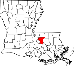 | |
| CDPs | ||
| Unincorporated communities | ||