Sierra de Albarracín
| Sierra de Albarracín | |
|---|---|
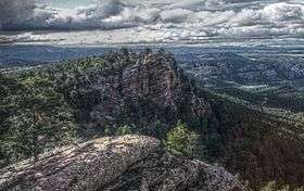 View of the Sierra de Albarracín | |
| Highest point | |
| Elevation | 1,856 m (6,089 ft) |
| Listing | Mountains of Aragon, List of mountains in the Valencian Community |
| Coordinates | 40°29′10″N 1°36′55″W / 40.48611°N 1.61528°WCoordinates: 40°29′10″N 1°36′55″W / 40.48611°N 1.61528°W |
| Geography | |
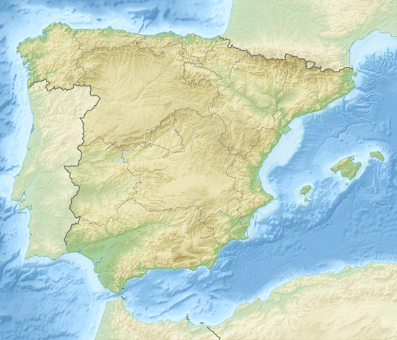 Sierra de Albarracín Spain | |
| Location | Rincón de Ademuz and Serrans, Valencian Community |
| Parent range | Iberian System, Eastern zone |
| Geology | |
| Mountain type | Shale (Late Ordovician)[1] |
| Climbing | |
| Easiest route | From the towns of Albarracín or Monterde de Albarracín |
Sierra de Albarracín is a 28 km (17 mi) long mountain range in the southwestern end of the Iberian System. Its highest point is the 1,856 m high summit known as Sierra Alta.[2]
Description
This mountain range is named after the town of Albarracín, located at a height of 1,200 m. At the same time it gives its name to the Sierra de Albarracín comarca of Aragon, Spain. Monterde de Albarracín is located at the northern end of the range.
The Sierra de Albarracín is a rough-looking mountain chain with pine, oak and juniper forests and also many patches where the rock is exposed. Its summits are usually covered in snow in the winter and the average temperature is of 11°C. It was formerly one of the most lonely and desolate areas of Spain and there were not even marked paths crossing its impenetrable forests and jagged ridges.[3]
Metopoceras albarracina is an endemic moth of these mountains.[4]
See also
References
- ↑ Late ordovician glaciomarine deposits (orea shale) in the sierra de albarracin, Spain
- ↑ Bronchales
- ↑ Enciclopedia Salvat, Vol I, Barcelona 1942
- ↑ Aramón Javalambre
External links
 Media related to Sierra de Albarracín at Wikimedia Commons
- Albarracín on Diputación de Teruel
- Turismo Albarracin
- Turismo en la Sierra de Albarracín (Teruel)
- The highest camping in Spain
- Social organization, reproductive behavior and ecology of Leptothorax acervorum (Hymenoptera, Formicidae) from the Sierra de Albarracin in central Spain