Sittaung
| Sittaung စစ်တောင်း Sittaw | |
|---|---|
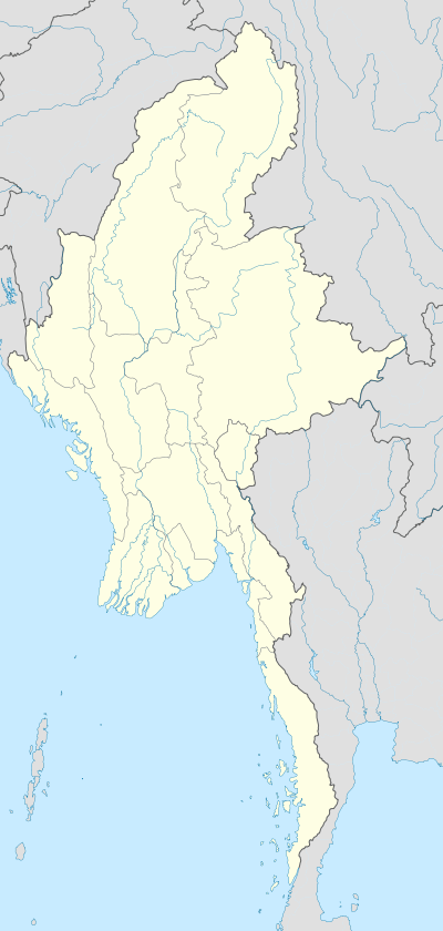 Sittaung Location of Sittaung, Burma | |
| Coordinates: 24°10′N 94°35′E / 24.167°N 94.583°ECoordinates: 24°10′N 94°35′E / 24.167°N 94.583°E | |
| Country | Burma |
| Division | Sagaing Division |
| District | Mawlaik |
| Township | Paungbyin |
| Time zone | MST (UTC+6.30) |
Sittaung (စစ်တောင်း) is a town in Paungbyin Township, Mawlaik District, in the Sagaing Region of Burma (Myanmar) on the right bank of the Chindwin River.[1] There is a highway running west to the Indian border which provides Tamu with access to transport on the Chindwin. This road was laid out in 1887 by troops under Major General J. J. H. Gordon to better link Manipur with Upper Burma.[2]
Notes
- ↑ "Map of Sagaing Division" Myanmars.net
- ↑ Gordon, J. J. H. (February 1889) "Overland from India to Upper Burma" The Illustrated Naval and Military Magazine New Series 1(2): pp. 187–200, page 199
External links
Capital: Sagaing | ||
| Hkamti District |  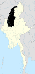 | |
| Kale District | ||
| Katha District | ||
| Mawlaik District | ||
| Monywa District | ||
| Sagaing District | ||
| Shwebo District | ||
| Tamu District | ||
| Yinmabin District | ||
| Naga Self-Administered Zone | ||
This article is issued from Wikipedia - version of the 10/16/2016. The text is available under the Creative Commons Attribution/Share Alike but additional terms may apply for the media files.