Soběchleby (Přerov District)
| Soběchleby | |||
|---|---|---|---|
| Municipality | |||
 | |||
| |||
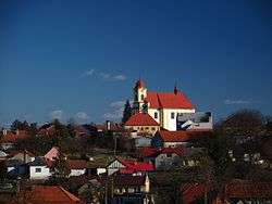
 Soběchleby | |||
| Coordinates: 49°28′43″N 17°38′45″E / 49.47861°N 17.64583°ECoordinates: 49°28′43″N 17°38′45″E / 49.47861°N 17.64583°E | |||
| Country |
| ||
| Region | Olomouc | ||
| District | Přerov | ||
| Area | |||
| • Total | 6.64 km2 (2.56 sq mi) | ||
| Elevation | 284 m (932 ft) | ||
| Population (2012) | |||
| • Total | 603 | ||
| • Density | 91/km2 (240/sq mi) | ||
| Postal code | 753 54 | ||
| Website | http://www.sobechleby.cz | ||


Soběchleby is a village and municipality (obec) in Přerov District in the Olomouc Region of the Czech Republic.
The municipality covers an area of 6.64 square kilometres (2.56 sq mi), and has a population of 612 (as at 28 August 2006).
Soběchleby lies approximately 15 kilometres (9 mi) east of Přerov, 32 km (20 mi) south-east of Olomouc, and 242 km (150 mi) east of Prague.
References
This article is issued from Wikipedia - version of the 4/7/2016. The text is available under the Creative Commons Attribution/Share Alike but additional terms may apply for the media files.