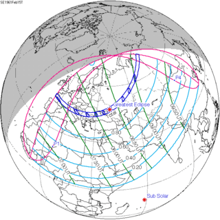
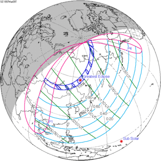
Solar eclipse of January 1, 1889
| Solar eclipse of January 1, 1889 | |
|---|---|
 Map | |
| Type of eclipse | |
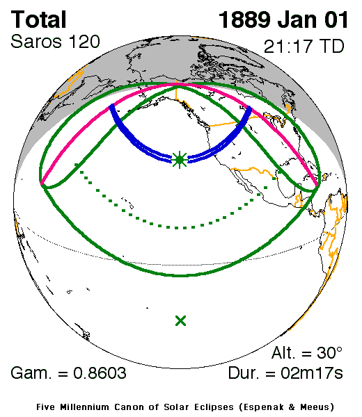
| Nature | Total |
| Gamma | 0.8603 |
| Magnitude | 1.0262 |
| Maximum eclipse | |
| Duration | 137 sec (2 m 17 s) |
| Coordinates | 36°42′N 137°36′W / 36.7°N 137.6°W |
| Max. width of band | 175 km (109 mi) |
| Times (UTC) | |
| Greatest eclipse | 21:16:50 |
| References | |
| Saros | 120 (54 of 71) |
| Catalog # (SE5000) | 9255 |
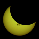
A total solar eclipse occurred on January 1, 1889. A solar eclipse occurs when the Moon passes between Earth and the Sun, thereby totally or partly obscuring the image of the Sun for a viewer on Earth. A total solar eclipse occurs when the Moon's apparent diameter is larger than the Sun's, blocking all direct sunlight, turning day into darkness. Totality occurs in a narrow path across Earth's surface, with the partial solar eclipse visible over a surrounding region thousands of kilometres wide. It was visible across western United States, and central Canada. Partiality was visible across the northern Pacific ocean including Hawaii, and all of the United States.
Observations and predictions

A drawing of map of path across the western United States and central Canada


Related eclipses
Saros 120
It is a part of Saros cycle 120, repeating every 18 years, 11 days, containing 71 events. The series started with partial solar eclipse on May 27, 933 AD, and reached an annular eclipse on August 11, 1059. It was a hybrid event for 3 dates: May 8, 1510, through May 29, 1546, and total eclipses from June 8, 1564, through March 30, 2033. The series ends at member 71 as a partial eclipse on July 7, 2195. The longest duration of totality was 2 minutes, 50 seconds on March 9, 1997.[1]
| Series members 55–65 occur between 1901 and 2100 | ||
|---|---|---|
| 55 | 56 | 57 |
 January 14, 1907 |
 January 24, 1925 |
 February 4, 1943 |
| 58 | 59 | 60 |
 February 15, 1961 |
 February 26, 1979 |
 March 9, 1997 |
| 61 | 62 | 63 |
 March 20, 2015 |
 March 30, 2033 |
 April 11, 2051 |
| 64 | 65 | |
 April 21, 2069 |
 May 2, 2087 | |
Notes
References
- NASA chart graphics
- Photo of Solar Corona January 1, 1889
- Total Eclipses of the Sun, By Mabel Loomis Todd, 1894, new and revised edition by David P. Todd, 1900.
- Eclipse of June 1, 1889. Contact print from the original glass negative. Lick Observatory Plate Archive, Mt. Hamilton. [January 1, 1889?!]
- On the solar eclipse of January 1, 1889 Holden, E. S., Journal: The Observatory, Vol. 12, p. 130-134 (1889)
- The Total Solar Eclipse of January 1 Nature 39, 487-488 (21 March 1889)
- C.E. Watkins photo / eclipse / lick observatory 1889?, The J. Paul Getty Museum, Object Number: 88.XM.92.83
| Wikimedia Commons has media related to Solar eclipse of 1889 January 1. |