Sorath prant
- See Sorath for namesakes
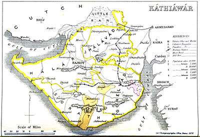
Sorath was the south(west)ern-most of the four prants (traditional regions) into which the many feudal units (mostly petty princely states) of Kathiawar on Saurashtra pensinsula in present Gujarat (western India) were divided, the others being Halar (west), Jhalawar (or Jalavad; north) and Gohilwad (southeast).
It roughly corresponds to the modern Porbandar District and Junagadh District.
It comprised 1,193 villages, covering 5,217 square miles, with a total population of 575,288 in 1901, yielding 5,399,349 Rupees state revenue (1903-4; of which 3,610,250 from land) and paying 215,060 Rupees tribute to the British, the Gaekwar Baroda State and/or the Junagadh State.
Princely States
| Princely state |
|---|
| Individual residencies |
| Agencies |
|
| Lists |
|
Its salute states were :
- First Class : Junagadh State, title Nawab, Hereditary salute of 13-guns (15-guns local and personal)
- Second Class : Porbandar State, title Maharaja Rana Sahib, Hereditary salute of 13-guns
Its main non-salute states included :
- First Class : Jafarabad State
- Third Class : Bantva Manavadar; third to seventh : Jetpur
- (No Fourth Class)
- Fifth Class : Bantva (Gidad), Dedan, Vasavad
- Sixth Class : Bagasra, Kuba, Vinchhavad
- (No Seventh Class)
Further petty states, often just a single village, were :
- Charkha, Dahida, Dholarva, Gadhia, Garmali Moti, Garmali Nani, Gigasaran, Halaria, Jamka, Kaner, Kathrota, Khijadia Najani, Lakhapadar, Manavav
- Monvel, Silana, Vaghvadi, Vekaria
Furthermore it included three civil stations, without talukdars : Dhasa, Jetalsar and Shahpur.