South Lopham
| South Lopham | |
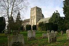 South Lopham church |
|
 South Lopham |
|
| Area | 7.91 km2 (3.05 sq mi) |
|---|---|
| Population | 371 (2001 census) |
| – density | 47/km2 (120/sq mi) |
| OS grid reference | TM043814 |
| Civil parish | South Lopham |
| District | Breckland |
| Shire county | Norfolk |
| Region | East |
| Country | England |
| Sovereign state | United Kingdom |
| Post town | DISS |
| Postcode district | IP22 |
| EU Parliament | East of England |
| Website | http://south-lophampc.norfolkparishes.gov.uk/ |
Coordinates: 52°23′33″N 1°00′05″E / 52.39254°N 1.00129°E
South Lopham is a civil parish in the English county of Norfolk. It covers an area of 7.91 km2 (3.05 sq mi) and had a population of 371 in 157 households at the 2001 census.[1] For the purposes of local government, it falls within the district of Breckland.
It is recorded in the Domesday Book as Lopham, later becoming known as Lopham-Parva to mirror the existing village of Lopham-Magna (now North Lopham), and then finally becoming known by its present name of South Lopham.[2]
Notes
| Wikimedia Commons has media related to South Lopham. |
- ↑ Census population and household counts for unparished urban areas and all parishes. Office for National Statistics & Norfolk County Council (2001). Retrieved 20 June 2009.
- ↑ Blomefield, Francis; Parkin, Charles (1805). An Essay Towards a Topographical History of the County of Norfolk (2nd ed.). p. 228. as available from Google books.
This article is issued from Wikipedia - version of the 11/7/2016. The text is available under the Creative Commons Attribution/Share Alike but additional terms may apply for the media files.