South Toledo Bend, Texas
| South Toledo Bend, Texas | |
|---|---|
| CDP | |
|
Satellite view of South Toldeo Bend | |
 | |
| Coordinates: 31°9′26″N 93°35′31″W / 31.15722°N 93.59194°WCoordinates: 31°9′26″N 93°35′31″W / 31.15722°N 93.59194°W | |
| Country | United States |
| State | Texas |
| County | Newton |
| Area | |
| • Total | 21.2 sq mi (54.8 km2) |
| • Land | 18.4 sq mi (47.8 km2) |
| • Water | 2.7 sq mi (7.0 km2) |
| Elevation | 180 ft (55 m) |
| Population (2000) | |
| • Total | 576 |
| • Density | 31.2/sq mi (12.1/km2) |
| Time zone | Central (CST) (UTC-6) |
| • Summer (DST) | CDT (UTC-5) |
| Area code(s) | 409 |
| FIPS code | 48-69326[1] |
| GNIS feature ID | 1852771[2] |

South Toledo Bend is a census-designated place (CDP) in Newton County, Texas, United States. The population was 576 at the 2000 census.
Geography
South Toledo Bend is located at 31°9′26″N 93°35′31″W / 31.15722°N 93.59194°W (31.157172, -93.591918).[3]
According to the United States Census Bureau, the CDP has a total area of 21.2 square miles (55 km2), of which, 18.5 square miles (48 km2) of it is land and 2.7 square miles (7.0 km2) of it (12.85%) is water.
Demographics
As of the census[1] of 2000, there were 576 people, 289 households, and 199 families residing in the CDP. The population density was 31.2 people per square mile (12.1/km²). There were 723 housing units at an average density of 39.2/sq mi (15.1/km²). The racial makeup of the CDP was 96.70% White, 2.26% African American, 0.35% Native American, 0.17% Asian, and 0.52% from two or more races. Hispanic or Latino of any race were 0.69% of the population.
There were 289 households out of which 10.0% had children under the age of 18 living with them, 64.0% were married couples living together, 2.1% had a female householder with no husband present, and 30.8% were non-families. 27.7% of all households were made up of individuals and 14.2% had someone living alone who was 65 years of age or older. The average household size was 1.99 and the average family size was 2.37.
In the CDP the population was spread out with 10.2% under the age of 18, 3.1% from 18 to 24, 15.1% from 25 to 44, 37.2% from 45 to 64, and 34.4% who were 65 years of age or older. The median age was 58 years. For every 100 females there were 100.0 males. For every 100 females age 18 and over, there were 102.7 males.
The median income for a household in the CDP was $37,697, and the median income for a family was $42,212. Males had a median income of $33,646 versus $14,375 for females. The per capita income for the CDP was $20,238. About 4.1% of families and 9.4% of the population were below the poverty line, including 8.1% of those under age 18 and 7.0% of those age 65 or over.
References
- 1 2 "American FactFinder". United States Census Bureau. Retrieved 2008-01-31.
- ↑ "US Board on Geographic Names". United States Geological Survey. 2007-10-25. Retrieved 2008-01-31.
- ↑ "US Gazetteer files: 2010, 2000, and 1990". United States Census Bureau. 2011-02-12. Retrieved 2011-04-23.
External links
Municipalities and communities of Newton County, Texas, United States | ||
|---|---|---|
| City | 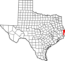 | |
| CDPs | ||
| Unincorporated communities | ||
| Ghost towns | ||