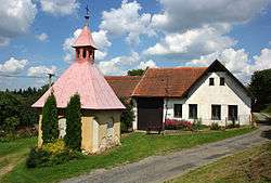
Střítež pod Křemešníkem
| Střítež pod Křemešníkem | |
|---|---|
| Municipality | |
 | |
 Střítež pod Křemešníkem | |
| Coordinates: 49°25′39″N 15°19′4″E / 49.42750°N 15.31778°ECoordinates: 49°25′39″N 15°19′4″E / 49.42750°N 15.31778°E | |
| Country |
|
| Region | Vysočina |
| District | Pelhřimov |
| Area | |
| • Total | 3.74 km2 (1.44 sq mi) |
| Elevation | 584 m (1,916 ft) |
| Population (1.1.2014) | |
| • Total | 66 |
| • Density | 18/km2 (46/sq mi) |
| Postal code | 393 01 |
| Website | http://www.stritezpodkremesnikem.cz |
Střítež pod Křemešníkem is a village and municipality (obec) in Pelhřimov District in the Vysočina Region of the Czech Republic.
The municipality covers an area of 3.74 square kilometres (1.44 sq mi), and has a population of 48 (as at 2 October 2006).
Střítež pod Křemešníkem lies approximately 8 kilometres (5 mi) east of Pelhřimov, 21 km (13 mi) west of Jihlava, and 98 km (61 mi) south-east of Prague.
References
| Wikimedia Commons has media related to Střítež pod Křemešníkem. |
This article is issued from Wikipedia - version of the 4/7/2016. The text is available under the Creative Commons Attribution/Share Alike but additional terms may apply for the media files.