St. Mary's Township, Hancock County, Illinois
| Saint Mary's Township | |
|---|---|
| Township | |
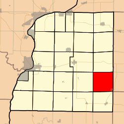 Location in Hancock County | |
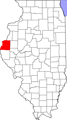 Hancock County's location in Illinois | |
| Coordinates: 40°19′38″N 90°58′03″W / 40.32722°N 90.96750°WCoordinates: 40°19′38″N 90°58′03″W / 40.32722°N 90.96750°W | |
| Country |
|
| State |
|
| County | Hancock |
| Established | November 6, 1849 |
| Area | |
| • Total | 36.93 sq mi (95.6 km2) |
| • Land | 36.93 sq mi (95.6 km2) |
| • Water | 0 sq mi (0 km2) 0% |
| Elevation | 538 ft (164 m) |
| Population (2010) | |
| • Total | 640 |
| • Density | 17.3/sq mi (6.7/km2) |
| Time zone | CST (UTC-6) |
| • Summer (DST) | CDT (UTC-5) |
| ZIP codes | 62316, 62321, 62367 |
| GNIS feature ID | 0429699 |
Saint Mary's Township is one of twenty-five townships in Hancock County, Illinois, USA. As of the 2010 census, its population was 640 and it contained 336 housing units.[1]
Geography
According to the 2010 census, the township has a total area of 36.93 square miles (95.6 km2), all land.[1]
Cities, towns, villages
- Plymouth (vast majority)
Major highways
School districts
- Southeastern Community Unit School District 337
Political districts
- Illinois's 17th congressional district
- State House District 94
- State Senate District 47
References
- United States Census Bureau 2008 TIGER/Line Shapefiles
- "Saint Mary's Township". Geographic Names Information System. United States Geological Survey. Retrieved 2009-09-20.
- United States National Atlas
- 1 2 "Population, Housing Units, Area, and Density: 2010 - County -- County Subdivision and Place -- 2010 Census Summary File 1". United States Census. Retrieved 2013-05-28.
External links

Municipalities and communities of Hancock County, Illinois, United States | ||
|---|---|---|
| Cities | ||
| Town | ||
| Villages | ||
| Townships | ||
| Unincorporated communities | ||
| Footnotes | ‡This populated place also has portions in an adjacent county or counties | |
This article is issued from Wikipedia - version of the 12/4/2013. The text is available under the Creative Commons Attribution/Share Alike but additional terms may apply for the media files.