Stamps, Arkansas
| Stamps, Arkansas | |
|---|---|
| Town | |
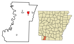 Location in Lafayette County and the state of Arkansas | |
| Coordinates: 33°21′35″N 93°29′51″W / 33.35972°N 93.49750°WCoordinates: 33°21′35″N 93°29′51″W / 33.35972°N 93.49750°W | |
| Country | United States |
| State | Arkansas |
| County | Lafayette |
| Area | |
| • Total | 3.2 sq mi (8.2 km2) |
| • Land | 3.1 sq mi (8 km2) |
| • Water | 0.1 sq mi (0.2 km2) |
| Elevation | 308 ft (94 m) |
| Population (2000) | |
| • Total | 2,131 |
| • Density | 665.9/sq mi (259.9/km2) |
| Time zone | Central (CST) (UTC-6) |
| • Summer (DST) | CDT (UTC-5) |
| ZIP code | 71860 |
| Area code(s) | 870 |
| FIPS code | 05-66320 |
| GNIS feature ID | 0058678 |
.jpg)
Stamps is a town in Lafayette County, Arkansas, United States. The population was 2,131 at the 2000 census.
A post office has been in operation in Stamps since 1887.[1] Stamps was the shop headquarters for the former Louisiana and Arkansas Railway until the relocation in the early 1920s to Minden in Webster Parish in north Louisiana.[2]
Stamps has frequently been noted on lists of unusual place names.[3][4] According to the postmaster Stamps is "the only town in the U.S. that stamps Stamps on stamps."[3]
History
The town was named for settler James Hardy Stamps.
Stamps was the childhood home of author Maya Angelou, and was depicted in her book, I Know Why the Caged Bird Sings.
From 1948-1950, the former professional football player George Doherty coached at Stamps High School and turned a winless team into two district championships and a second-place finish statewide.
Geography
According to the United States Census Bureau, the city has a total area of 3.2 square miles (8.3 km2). 3.1 square miles (8.0 km2) of it is land and 0.1 square miles (0.26 km2) of it (2.54%) is water.
Demographics
| Historical population | |||
|---|---|---|---|
| Census | Pop. | %± | |
| 1900 | 1,021 | — | |
| 1910 | 2,316 | 126.8% | |
| 1920 | 2,564 | 10.7% | |
| 1930 | 2,705 | 5.5% | |
| 1940 | 2,405 | −11.1% | |
| 1950 | 2,552 | 6.1% | |
| 1960 | 2,591 | 1.5% | |
| 1970 | 2,448 | −5.5% | |
| 1980 | 2,859 | 16.8% | |
| 1990 | 2,478 | −13.3% | |
| 2000 | 2,131 | −14.0% | |
| 2010 | 1,693 | −20.6% | |
| Est. 2015 | 1,551 | [5] | −8.4% |
As of the census[7] of 2000, there were 2,131 people, 830 households, and 541 families residing in the town. The population density was 693.7 people per square mile (268.0/km²). There were 1,003 housing units at an average density of 326.5 per square mile (126.1/km²). The racial makeup of the city was 44.30% White, 54.48% Black or African American, 0.52% Native American, 0.09% Asian, 0.05% Pacific Islander, and 0.56% from two or more races. 0.61% of the population were Hispanic or Latino of any race.
There were 830 households out of which 30.7% had children under the age of 18 living with them, 37.8% were married couples living together, 21.7% had a female householder with no husband present, and 34.7% were non-families. 31.7% of all households were made up of individuals and 17.6% had someone living alone who was 65 years of age or older. The average household size was 2.46 and the average family size was 3.10.
In the city the population was spread out with 27.1% under the age of 18, 9.1% from 18 to 24, 23.7% from 25 to 44, 20.6% from 45 to 64, and 19.5% who were 65 years of age or older. The median age was 37 years. For every 100 females there were 87.6 males. For every 100 females age 18 and over, there were 77.6 males.
The median income for a household in the town was $22,194, and the median income for a family was $26,591. Males had a median income of $25,667 versus $17,125 for females. The per capita income for the city was $11,440. About 22.8% of families and 27.8% of the population were below the poverty line, including 31.0% of those under age 18 and 24.2% of those age 65 or over.
Education
Public education for elementary and secondary students is provided by the Lafayette County School District, which includes Lafayette County Elementary School and Lafayette County High School. The school's mascot and athletic emblem is the Cougar.
Infrastructure
Highways
Notable people
References
- ↑ "Lafayette County". Jim Forte Postal History. Retrieved 2 February 2015.
- ↑ "Connell Fort Dies Saturday Night at His Residence Here: Was Great Civic Worker and Builder of This town," Webster Signal-Tribune, March 5, 1937, pp. 1, 6
- 1 2 Hillinger, Charles (October 13, 1985). "Arkansas' Towns of Funny Names : There's Evening Shade, Greasy Corner, Stump City, Hope". Los Angeles Times. Retrieved 14 July 2014.
- ↑ Thompson, George E. (2009). You Live Where?: Interesting and Unusual Facts about where We Live. iUniverse. p. 8.
- ↑ "Annual Estimates of the Resident Population for Incorporated Places: April 1, 2010 to July 1, 2015". Retrieved July 2, 2016.
- ↑ "Census of Population and Housing". Census.gov. Retrieved June 4, 2015.
- ↑ "American FactFinder". United States Census Bureau. Retrieved 2008-01-31.
Municipalities and communities of Lafayette County, Arkansas, United States | ||
|---|---|---|
| Cities | 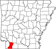 | |
| Town | ||
| Unincorporated communities | ||