Sterling, North Dakota
| Sterling, North Dakota | |
|---|---|
| Unincorporated community | |
 Sterling, North Dakota Location within the state of North Dakota | |
| Coordinates: 46°50′38″N 100°16′5″W / 46.84389°N 100.26806°WCoordinates: 46°50′38″N 100°16′5″W / 46.84389°N 100.26806°W | |
| Country | United States |
| State | North Dakota |
| County | Burleigh |
| Area | |
| • Total | 36.0 sq mi (93.2 km2) |
| • Land | 36.0 sq mi (93.2 km2) |
| • Water | 0.0 sq mi (0.0 km2) |
| Elevation | 1,932 ft (589 m) |
| Population (2000) | |
| • Total | 172 |
| • Density | 4.8/sq mi (1.8/km2) |
| Time zone | Central (CST) (UTC-6) |
| • Summer (DST) | CDT (UTC-5) |
| ZIP code | 58572 |
| Area code(s) | 701 |
| FIPS code | 38-75940[1] |
| GNIS feature ID | 1759347[2] |
Sterling is an unincorporated community in Burleigh County, North Dakota, United States at the intersection of Interstate 94 and U.S. Route 83. It is part of the "Bismarck, ND Metropolitan Statistical Area" or "Bismarck-Mandan". Sterling's US Postal Code is 58572.
Sterling was not a census-designated place in the 2000 census.
References
- ↑ "American FactFinder". United States Census Bureau. Retrieved 2008-01-31.
- ↑ "US Board on Geographic Names". United States Geological Survey. 2007-10-25. Retrieved 2008-01-31.
Municipalities and communities of Burleigh County, North Dakota, United States | ||
|---|---|---|
| Cities | 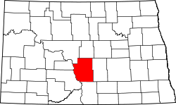 | |
| Townships |
| |
| CDPs | ||
| Unorganized territories |
| |
| Unincorporated communities | ||
| Footnotes | ‡This populated place also has portions in an adjacent county or counties | |
| Counties |  | |
|---|---|---|
| Core cities | ||
| Surrounding areas |
| |
This article is issued from Wikipedia - version of the 7/31/2014. The text is available under the Creative Commons Attribution/Share Alike but additional terms may apply for the media files.