Stratton, Vermont
| Stratton, Vermont | |
|---|---|
| Town | |
 Stratton, Vermont | |
 Stratton, Vermont Location in the United States | |
| Coordinates: 43°3′41″N 72°54′15″W / 43.06139°N 72.90417°WCoordinates: 43°3′41″N 72°54′15″W / 43.06139°N 72.90417°W | |
| Country | United States |
| State | Vermont |
| County | Windham |
| Area | |
| • Total | 46.9 sq mi (121.5 km2) |
| • Land | 46.4 sq mi (120.1 km2) |
| • Water | 0.5 sq mi (1.4 km2) |
| Elevation | 3,199 ft (975 m) |
| Population (2000) | |
| • Total | 216 |
| • Density | 2.9/sq mi (1.1/km2) |
| Time zone | Eastern (EST) (UTC-5) |
| • Summer (DST) | EDT (UTC-4) |
| ZIP code | 05360 |
| Area code(s) | 802 |
| FIPS code | 50-70750[1] |
| GNIS feature ID | 1462221[2] |
Stratton is a town in Windham County, Vermont, United States. The population was 136 at the 2000 census and 216 in 2010.[3]
Geography
According to the United States Census Bureau, the town has a total area of 46.9 square miles (121.5 km2), of which 46.4 square miles (120.1 km2) is land and 0.5 square mile (1.4 km2) (1.15%) is water. Stratton Mountain is the high point of the town.
History
Daniel Webster spoke to 10,000 Whigs on Stratton Mountain in 1840.[4] Stratton was one of thirteen Vermont towns isolated by flooding caused by Hurricane Irene in 2011.[5]
Demographics
| Historical population | |||
|---|---|---|---|
| Census | Pop. | %± | |
| 1790 | 95 | — | |
| 1800 | 271 | 185.3% | |
| 1810 | 265 | −2.2% | |
| 1820 | 272 | 2.6% | |
| 1830 | 312 | 14.7% | |
| 1840 | 341 | 9.3% | |
| 1850 | 286 | −16.1% | |
| 1860 | 366 | 28.0% | |
| 1870 | 294 | −19.7% | |
| 1880 | 302 | 2.7% | |
| 1890 | 222 | −26.5% | |
| 1900 | 271 | 22.1% | |
| 1910 | 86 | −68.3% | |
| 1920 | 90 | 4.7% | |
| 1930 | 55 | −38.9% | |
| 1940 | 117 | 112.7% | |
| 1950 | 54 | −53.8% | |
| 1960 | 38 | −29.6% | |
| 1970 | 104 | 173.7% | |
| 1980 | 122 | 17.3% | |
| 1990 | 121 | −0.8% | |
| 2000 | 136 | 12.4% | |
| 2010 | 216 | 58.8% | |
| Est. 2014 | 212 | [6] | −1.9% |
| U.S. Decennial Census[7] | |||
As of the census[1] of 2000, there were 136 people, 60 households, and 36 families residing in the town. The population density was 2.9 people per square mile (1.1/km2). There were 1,091 housing units at an average density of 23.5 per square mile (9.1/km2). The racial makeup of the town was 98.53% White, and 1.47% from two or more races. Hispanic or Latino of any race were 2.94% of the population.
There were 60 households out of which 26.7% had children under the age of 18 living with them, 56.7% were married couples living together, 1.7% had a female householder with no husband present, and 40.0% were non-families. 28.3% of all households were made up of individuals and 11.7% had someone living alone who was 65 years of age or older. The average household size was 2.27 and the average family size was 2.89.
In the town the population was spread out with 21.3% under the age of 18, 3.7% from 18 to 24, 30.9% from 25 to 44, 26.5% from 45 to 64, and 17.6% who were 65 years of age or older. The median age was 42 years. For every 100 females there were 106.1 males. For every 100 females age 18 and over, there were 114.0 males.
Economy
Personal income
The median income for a household in the town was $39,688, and the median income for a family was $43,750. Males had a median income of $36,875 versus $28,125 for females. The per capita income for the town was $32,489. There were none of the families and 5.0% of the population living below the poverty line, including no under eighteens and none of those over 64.
Industry
Tourism
Stratton Mountain Resort is a resort on Stratton Mountain. This was the first ski resort to allow snowboarding. It has 91 ski trails and snowmaking capability.
Elections
Between 1988 and 2004, the town did not vote for the same national party ticket two elections in a row, unique in the state.[8]
Notable people
- Lindsey Jacobellis, Olympic snowboarder
- Ross Powers, Olympic & world champion snowboarder
- Louis Vito, Olympic snowboarder and contestant on Dancing With The Stars
- Robert Penn Warren, poet and novelist
References
- 1 2 "American FactFinder". United States Census Bureau. Retrieved 2008-01-31.
- ↑ "US Board on Geographic Names". United States Geological Survey. 2007-10-25. Retrieved 2008-01-31.
- ↑ "Community Facts". American Factfinder. 2010. Retrieved 13 February 2014.
- ↑
- ↑ Floodwaters From Storm Isolate 13 Vermont Towns, The New York Times
- ↑ "Annual Estimates of the Resident Population for Incorporated Places: April 1, 2010 to July 1, 2014". Retrieved June 4, 2015.
- ↑ "U.S. Decennial Census". United States Census Bureau. Retrieved May 16, 2015.
- ↑ Hemmingway, Sam (October 19, 2008). BLUE:Vermont's Democratic shift. Burlington Free Press.
External links
Municipalities and communities of Windham County, Vermont, United States | ||
|---|---|---|
| Towns | 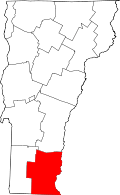 | |
| Villages | ||
| CDPs | ||
| Other communities | ||
| Footnotes | ‡ Disincorporated | |