Stratton Township, Edgar County, Illinois
| Stratton Township | |
|---|---|
| Township | |
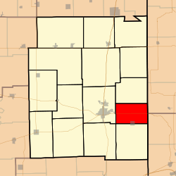 Location in Edgar County | |
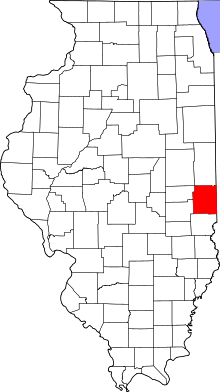 Edgar County's location in Illinois | |
| Coordinates: 39°36′25″N 87°35′28″W / 39.60694°N 87.59111°WCoordinates: 39°36′25″N 87°35′28″W / 39.60694°N 87.59111°W | |
| Country | United States |
| State | Illinois |
| County | Edgar |
| Established | November 4, 1856 |
| Area | |
| • Total | 24.8 sq mi (64 km2) |
| • Land | 24.8 sq mi (64 km2) |
| • Water | 0 sq mi (0 km2) 0% |
| Elevation | 666 ft (203 m) |
| Population (2010) | |
| • Total | 481 |
| • Density | 19.4/sq mi (7.5/km2) |
| Time zone | CST (UTC-6) |
| • Summer (DST) | CDT (UTC-5) |
| ZIP code | 61944 |
| GNIS feature ID | 0429804 |
Stratton Township is one of fifteen townships in Edgar County, Illinois, USA. As of the 2010 census, its population was 481 and it contained 230 housing units.[1] The name of the township was Wayne Township until May 9, 1857.
Geography
According to the 2010 census, the township has a total area of 24.8 square miles (64 km2), all land.[1]
Cities, towns, villages
- Vermilion (north three-quarters)
Extinct towns
- Kentucky
Cemeteries
The township contains these three cemeteries: Blackburn, Little Grove and Pryor. There have been records found for Oak Grove, Whalen, and Wilkins.
Major highways
School districts
- Paris Community Unit School District 4
Political districts
- Illinois' 15th congressional district
- State House District 109
- State Senate District 55
References
- "Stratton Township, Edgar County, Illinois". Geographic Names Information System. United States Geological Survey. Retrieved 2010-01-10.
- United States Census Bureau 2007 TIGER/Line Shapefiles
- United States National Atlas
- 1 2 "Population, Housing Units, Area, and Density: 2010 - County -- County Subdivision and Place -- 2010 Census Summary File 1". United States Census. Retrieved 2013-05-28.
External links
 |
Hunter Township | | ||
| Paris Township | |
Clinton Township, Vermillion County, Indiana Fayette Township, Vigo County, Indiana | ||
| ||||
| | ||||
| Symmes Township | Elbridge Township |
Municipalities and communities of Edgar County, Illinois, United States | ||
|---|---|---|
| Cities | ||
| Villages | ||
| Townships | ||
| Unincorporated communities | ||
| Footnotes | ‡This populated place also has portions in an adjacent county or counties | |
This article is issued from Wikipedia - version of the 6/18/2014. The text is available under the Creative Commons Attribution/Share Alike but additional terms may apply for the media files.