Suffolk Downs (MBTA station)
SUFFOLK DOWNS | |||||||||||
|---|---|---|---|---|---|---|---|---|---|---|---|
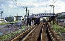
 Suffolk Downs station in February 2012 | |||||||||||
| Location |
1230 Bennington Street at Walley Street East Boston, Massachusetts | ||||||||||
| Coordinates | 42°23′25″N 70°59′49″W / 42.3904°N 70.9970°WCoordinates: 42°23′25″N 70°59′49″W / 42.3904°N 70.9970°W | ||||||||||
| Line(s) | |||||||||||
| Platforms | 2 side platforms | ||||||||||
| Tracks | 2 | ||||||||||
| Construction | |||||||||||
| Parking |
110 spaces ($5.00 fee) 4 accessible spaces | ||||||||||
| Bicycle facilities | 12 spaces | ||||||||||
| Disabled access | Yes | ||||||||||
| History | |||||||||||
| Opened |
c. 1905 (BRB&L - Belle Isle) 1935 (BRB&L - Suffolk Downs) April 21, 1952 (rapid transit)[1] | ||||||||||
| Closed |
c. 1925 (BRB&L - Belle Isle) January 27, 1940 (BRB&L - Suffolk Downs)[2] February 14, 1976 (outbound platform)[1] | ||||||||||
| Rebuilt |
January 3, 1984 June 24, 1995[1] | ||||||||||
| Previous names | Belle Isle (c. 1905 - c. 1925) | ||||||||||
| Traffic | |||||||||||
| Passengers (2013) | 1,125 (weekday average boardings)[3] | ||||||||||
| Services | |||||||||||
| |||||||||||
Suffolk Downs is a rapid transit station on the MBTA Blue Line located off Bennington Street on the east side of Orient Heights in East Boston, Massachusetts. It serves the Orient Heights neighborhood as well as its namesake, the now-defunct Suffolk Downs racetrack.
Originally a Boston, Revere Beach and Lynn Railroad station called Belle Isle and Suffolk Downs from the early 1900s to 1940, it reopened in 1952 as a rapid transit station on the Revere Extension of the East Boston Tunnel line (now the Blue Line).
With just 1125 daily boardings in 2013, Suffolk Downs is the least-used rapid transit station on the MBTA system.[3] It is fully handicapped accessible.
History
The narrow gauge Boston, Revere Beach and Lynn Railroad (BRB&L) opened from East Boston to Lynn through Breed's Hill (not yet part of East Boston) on July 29, 1875; there was initially no station at the modern site.[4] A stop named Belle Isle opened at Waldemar Avenue around 1905.[5][6][7] Just 2,000 feet (610 m) from Orient Heights station, it closed around 1925 and suffered a number of fires in 1925 and 1926 caused by sparks from locomotives.[8][9][10][11]
By 1928 the line was electrified, with pre-pay stations - more a rapid transit line than a conventional railroad.[11] The station was reopened and renamed Suffolk Downs when the horse-racing track opened in 1935.[12] Due to the Great Depression, the BRB&L shut down on January 27, 1940.[2]
Rapid transit
In 1941, the Boston Elevated Railway bought the BRB&L right of way from Day Square to Revere Beach for use as a high-speed trolley line similar to the Ashmont-Mattapan High Speed Line; these plans were delayed by the onset of World War II.[13] However, the 1926 Report on Improved Transportation Facilities and 1945–47 Coolidge Commission Report recommended that the East Boston Tunnel line, which had been converted to rapid transit from streetcars in 1924, be extended to Lynn via the BBRB&L route rather than using it for a trolley line.[14][15]
In 1947, the newly formed Metropolitan Transit Authority (M.T.A.) decided to build to Lynn as a rapid transit line, and construction began in October 1948.[13] The first part of the Revere Extension opened to Orient Heights on January 5, 1952 and to Suffolk Downs on April 21, 1952; the second phase (cut short due to limited funds) opened to Wonderland on January 19, 1954.[1][13]
Renovations

The 1952 station lost its outbound platform to fire on February 14, 1976, leaving only the inbound platform open, which hurt attendance at races.[1] The station was rebuilt in 1983 after the project received a $1.9 million grant from the Urban Mass Transportation Administration; the new handicapped accessible station fully opened on January 3, 1984.[1][16]
The station was closed for one year starting on June 25, 1994 as Suffolk Downs, Beachmont, Revere Beach, and Wonderland stations were rebuilt as part of the Blue Line Modernization Program. Blue Line service temporarily ended at Orient Heights and buses served the closed outer stations during the $467 million improvement project.[1][17] Because Suffolk Downs station had been completely rebuilt just a decade before, it needed just $3 million worth of work, compared to $9 million each at Revere Beach and Wonderland and $27 million for a completely new station at Beachmont. The stations reopened on June 24, 1995.[1][18]
Unusually for an MBTA rapid transit station, Suffolk Downs has no MBTA Bus connections.[19] However, during the 2013 closure of Orient Heights, Suffolk Downs was used as the terminus of replacement shuttle bus service.[1]
Platform layout
.jpg)
| Platform level | Side platform, doors will open on the right | |
| Southbound | ← Blue Line toward Bowdoin or Government Center (Orient Heights) | |
| Northbound | → Blue Line toward Wonderland (Beachmont) → | |
| Ground | - | Exit/Entrance |
References
- 1 2 3 4 5 6 7 8 9 Belcher, Jonathan (27 June 2015). "Changes to Transit Service in the MBTA district 1964-2015" (PDF). NETransit. Retrieved 4 December 2015.
- 1 2 Karr, Ronald Dale (1995). The Rail Lines of Southern New England. Branch Line Press. pp. 268–272. ISBN 0942147022.
- 1 2 "Ridership and Service Statistics" (PDF) (14 ed.). Massachusetts Bay Transportation Authority. 2014. Retrieved 4 December 2015.
- ↑ Bradlee, Francis Boardman Crowninshield (1921). The Boston, Revere Beach and Lynn Narrow Gauge Railroad. Essex Institute. pp. 4–5 – via Google Books.
- ↑ "Part of the Metropolitan District (Everett, Chelsea, and East Boston.)". Atlas of Massachusetts, compiled under the direction of O.W. Walker, C.E. Geo. H. Walker & Co. 1904 – via WardMaps.
- ↑ "Sheet 3". Complete Road Atlas of Massachusetts and Rhode Island. The Scarborough Company. 1905 – via WardMaps.
- ↑ "Outline and Index Map of Charlestown and East Boston". Atlas of the City of Boston: Charlestown and East Boston. G.W. Bromley and Co. 1912. Retrieved 4 December 2015 – via Ward Maps.
- ↑ "East Boston District". Boston Daily Globe. 14 May 1925. p. A12 – via Proquest Historical Newspapers. (subscription required (help)).
Sparks from a passing locomotive set tire to the one-story wooden tool house near the Belle Isle station of the Boston, Revere Beach & Lynn Railroad
- ↑ "East Boston District". Boston Daily Globe. 26 August 1925. p. A11 – via Proquest Historical Newspapers. (subscription required (help)).
...for a fire on the roof of the old Belle Isle station of the Boston, Revere Beach & Lynn Railroad
- ↑ "East Boston District". Boston Daily Globe. 2 August 1925. p. A10 – via Proquest Historical Newspapers. (subscription required (help)).
...for a blaze in a one-story wooden building, unoccupied, on the roadbed of the Boston, Revere Beach & Lynn Railroad. This is the fifth time in as many weeks that the local firemen have been summoned to this structure. The cause of the fire given out yesterday by authorities was sparks from a passing locomotive.
- 1 2 ""Narrow Gage" Electrified for Economy". Electric Railway Journal. 72 (23): 991–998. 8 December 1928. Retrieved 24 December 2015 – via Internet Archive.
- ↑ Map of the Boston, Revere Beach & Lynn R.R., Boston, Revere Beach and Lynn Railroad, 1939
- 1 2 3 Cheney, Frank (2003). Boston's Blue Line. Arcadia Publishing. pp. 8, 83. ISBN 9780738535760.
- ↑ Central Transportation Planning Staff (15 November 1993). "The Transportation Plan for the Boston Region - Volume 2". National Transportation Library. Retrieved 3 July 2012.
- ↑ Boston Elevated Railway and Boston Department of Public Utilities (1945), Boston Rapid Transit System & Proposed Extentions 1945 - Metropolitan Transit Recess Commission Air View
- ↑ Temple, Robert (2009). The Pilgrims Would Be Shocked: The History of Thoroughbred Racing in New England. Robert Temple. ISBN 978-1-4415-1428-8.
- ↑ Blake, Andrew (20 March 1994). "MBTA to begin $467 million Blue Line project". Boston Globe. Retrieved 26 January 2014 – via Highbeam Research. (subscription required (help)).
- ↑ Blake, Andrew (18 June 1995). "Blue Line Stations Set to Reopen After $467M Upgrade". Boston Globe. Retrieved 4 July 2015 – via Highbeam Research. (subscription required (help)).
- ↑ "Suffolk Downs Station Neighborhood Map" (PDF). Massachusetts Bay Transportation Authority. July 2010. Retrieved 24 December 2015.
External links
| Wikimedia Commons has media related to Suffolk Downs (MBTA station). |
- MBTA - Suffolk Downs
- Bennington Street entrance from Google Maps Street View
- Walley Street entrance from Google Maps Street View
| Subway lines (List of stations) |
| |||||||||||
|---|---|---|---|---|---|---|---|---|---|---|---|---|
| Commuter Rail lines (List of stations) |
| |||||||||||
| Bus routes (List of routes) | ||||||||||||
| Other services | ||||||||||||
| Component parts of system lines | ||||||||||||
| Capital projects |
| |||||||||||
| History |
| |||||||||||
| Other | ||||||||||||