Summertown, Georgia
| Summertown, Georgia | |
|---|---|
| City | |
 Location in Emanuel County and the state of Georgia | |
| Coordinates: 32°44′48″N 82°16′34″W / 32.74667°N 82.27611°W | |
| Country | United States |
| State | Georgia |
| County | Emanuel |
| Area | |
| • Total | 0.79 sq mi (2.05 km2) |
| • Land | 0.79 sq mi (2.04 km2) |
| • Water | 0.004 sq mi (0.01 km2) |
| Elevation | 253 ft (77 m) |
| Population (2010) | |
| • Total | 160 |
| • Density | 203/sq mi (78.5/km2) |
| Time zone | Eastern (EST) (UTC-5) |
| • Summer (DST) | EDT (UTC-4) |
| ZIP code | 30401 |
| Area code(s) | 478 |
| FIPS code | 13-74348[1] |
| GNIS feature ID | 0323743[2] |
Summertown is a city in Emanuel County, Georgia, United States. The population was 160 at the 2010 census.[3]
Geography
Summertown is located in northern Emanuel County at 32°44′48″N 82°16′34″W / 32.74667°N 82.27611°WCoordinates: 32°44′48″N 82°16′34″W / 32.74667°N 82.27611°W (32.746532, -82.276182).[4] Georgia State Route 56 passes through the east side of the city limits, leading north 5 miles (8 km) to Midville and south 11 miles (18 km) to Swainsboro, the county seat.
According to the United States Census Bureau, Summertown has a total area of 0.77 square miles (2.0 km2), of which 0.004 square miles (0.01 km2), or 0.54%, is water.[3]
Demographics
| Historical population | |||
|---|---|---|---|
| Census | Pop. | %± | |
| 1970 | 159 | — | |
| 1980 | 215 | 35.2% | |
| 1990 | 153 | −28.8% | |
| 2000 | 140 | −8.5% | |
| 2010 | 160 | 14.3% | |
| Est. 2015 | 163 | [5] | 1.9% |
As of the census[1] of 2000, there were 140 people, 48 households, and 34 families residing in the town. The population density was 176.1 people per square mile (67.6/km²). There were 58 housing units at an average density of 73.0 per square mile (28.0/km²). The racial makeup of the town was 52.14% White, 39.29% African American, 3.57% Native American, 2.86% from other races, and 2.14% from two or more races. Hispanic or Latino of any race were 3.57% of the population.
There were 48 households out of which 39.6% had children under the age of 18 living with them, 52.1% were married couples living together, 14.6% had a female householder with no husband present, and 27.1% were non-families. 25.0% of all households were made up of individuals and 16.7% had someone living alone who was 65 years of age or older. The average household size was 2.92 and the average family size was 3.51.
In the town the population was spread out with 34.3% under the age of 18, 5.7% from 18 to 24, 25.0% from 25 to 44, 20.0% from 45 to 64, and 15.0% who were 65 years of age or older. The median age was 33 years. For every 100 females there were 125.8 males. For every 100 females age 18 and over, there were 109.1 males.
The median income for a household in the town was $35,750, and the median income for a family was $36,250. Males had a median income of $30,000 versus $19,583 for females. The per capita income for the town was $11,321. There were 5.9% of families and 12.3% of the population living below the poverty line, including 17.0% of under eighteens and 15.8% of those over 64.
References
- 1 2 "American FactFinder". United States Census Bureau. Retrieved 2008-01-31.
- ↑ "US Board on Geographic Names". United States Geological Survey. 2007-10-25. Retrieved 2008-01-31.
- 1 2 "Geographic Identifiers: 2010 Demographic Profile Data (G001): Summertown city, Georgia". American Factfinder. U.S. Census Bureau. Retrieved January 27, 2016.
- ↑ "US Gazetteer files: 2010, 2000, and 1990". United States Census Bureau. 2011-02-12. Retrieved 2011-04-23.
- ↑ "Annual Estimates of the Resident Population for Incorporated Places: April 1, 2010 to July 1, 2015". Retrieved July 2, 2016.
- ↑ "Census of Population and Housing". Census.gov. Retrieved June 4, 2015.
External links
- Summerville historical marker
Municipalities and communities of Emanuel County, Georgia, United States | ||
|---|---|---|
| Cities | 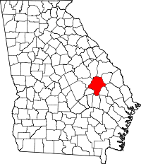 | |
| CDPs | ||
| Footnotes | ‡This populated place also has portions in an adjacent county or counties | |