Svirstroy
| Svirstroy (English) Свирьстрой (Russian) | |
|---|---|
| - Urban-type settlement[1] - | |
|
| |
.svg.png) Location of Leningrad Oblast in Russia | |
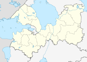 Svirstroy | |
|
| |
| Administrative status | |
| Country | Russia |
| Federal subject | Leningrad Oblast |
| Administrative district | Lodeynopolsky District[1] |
| Municipal status (as of February 2010) | |
| Municipal district | Lodeynopolsky Municipal District[2] |
| Urban settlement | Svirstroyskoye Urban Settlement[2] |
| Administrative center of | Svirstroyskoye Urban Settlement[2] |
| Statistics | |
| Population (2010 Census) | 927 inhabitants[3] |
| Time zone | MSK (UTC+03:00)[4] |
| Urban-type settlement status since | 1931[5] |
| Svirstroy on Wikimedia Commons | |
Svirstroy (Russian: Свирьстрой) is an urban locality (an urban-type settlement) in Lodeynopolsky District of Leningrad Oblast, Russia, located on the left bank of the Svir River several kilometers northeast of the town of Lodeynoye Pole. Municipally, it is incorporated as Svirstroyskoye Urban Settlement, one of the two urban settlements in the district. The name of the settlement is an abbreviation meaning Construction on the Svir. Population: 927 (2010 Census);[3] 1,044 (2002 Census);[6] 1,156 (1989 Census).[7]
History
In 1927, a large-scale construction of the Lower Svir Hydroelectric Station started, and subsequently in 1931, the concentration camp of Svirlag was established. The settlement which hosted the headquarters of Svirlag became known as Svirstroy. In the same year, Svirstroy was granted urban-type settlement status. On May 13, 1963, during the abortive Khrushhyov administrative reform, Svirstroy was subordinated to the town of Podporozhye, but on January 13, 1965 it was transferred back to Lodeynopolsky District.[5]
Economy
The economy of the settlement is essentially based on the Lower Svir Hydroelectric Station.
Transportation
A paved road connecting Lodeynoye Pole with Podporozhye and Vytegra passes Svirstroy.
The Svir River is navigable and is a part of the Volga–Baltic Waterway, connecting the basins of the Volga and the Neva Rivers. There is regular cruise and cargo traffic along the waterway.
References
Notes
- 1 2 Государственный комитет Российской Федерации по статистике. Комитет Российской Федерации по стандартизации, метрологии и сертификации. №ОК 019-95 1 января 1997 г. «Общероссийский классификатор объектов административно-территориального деления. Код 41 227 554 009», в ред. изменения №259/2014 от 12 декабря 2014 г.. (State Statistics Committee of the Russian Federation. Committee of the Russian Federation on Standardization, Metrology, and Certification. #OK 019-95 January 1, 1997 Russian Classification of Objects of Administrative Division . Code 41 227 554 009, as amended by the Amendment #259/2014 of December 12, 2014. ).
- 1 2 3 Law #78-oz
- 1 2 Russian Federal State Statistics Service (2011). "Всероссийская перепись населения 2010 года. Том 1" [2010 All-Russian Population Census, vol. 1]. Всероссийская перепись населения 2010 года (2010 All-Russia Population Census) (in Russian). Federal State Statistics Service. Retrieved June 29, 2012.
- ↑ Правительство Российской Федерации. Федеральный закон №107-ФЗ от 3 июня 2011 г. «Об исчислении времени», в ред. Федерального закона №271-ФЗ от 03 июля 2016 г. «О внесении изменений в Федеральный закон "Об исчислении времени"». Вступил в силу по истечении шестидесяти дней после дня официального опубликования (6 августа 2011 г.). Опубликован: "Российская газета", №120, 6 июня 2011 г. (Government of the Russian Federation. Federal Law #107-FZ of June 31, 2011 On Calculating Time, as amended by the Federal Law #271-FZ of July 03, 2016 On Amending Federal Law "On Calculating Time". Effective as of after sixty days following the day of the official publication.).
- 1 2 Лодейнопольский район (с августа 1927) (in Russian). Система классификаторов исполнительных органов государственной власти Санкт-Петербурга. Retrieved December 9, 2012.
- ↑ Russian Federal State Statistics Service (May 21, 2004). "Численность населения России, субъектов Российской Федерации в составе федеральных округов, районов, городских поселений, сельских населённых пунктов – районных центров и сельских населённых пунктов с населением 3 тысячи и более человек" [Population of Russia, Its Federal Districts, Federal Subjects, Districts, Urban Localities, Rural Localities—Administrative Centers, and Rural Localities with Population of Over 3,000] (XLS). Всероссийская перепись населения 2002 года [All-Russia Population Census of 2002] (in Russian). Retrieved August 9, 2014.
- ↑ Demoscope Weekly (1989). "Всесоюзная перепись населения 1989 г. Численность наличного населения союзных и автономных республик, автономных областей и округов, краёв, областей, районов, городских поселений и сёл-райцентров" [All Union Population Census of 1989: Present Population of Union and Autonomous Republics, Autonomous Oblasts and Okrugs, Krais, Oblasts, Districts, Urban Settlements, and Villages Serving as District Administrative Centers]. Всесоюзная перепись населения 1989 года [All-Union Population Census of 1989] (in Russian). Институт демографии Национального исследовательского университета: Высшая школа экономики [Institute of Demography at the National Research University: Higher School of Economics]. Retrieved August 9, 2014.
Sources
- Законодательное собрание Ленинградской области. Областной закон №32-оз от 15 июня 2010 г. «Об административно-территориальном устройстве Ленинградской области и порядке его изменения», в ред. Областного закона №23-оз от 8 мая 2014 г. «Об объединении муниципальных образований "Приморское городское поселение" Выборгского района Ленинградской области и "Глебычевское сельское поселение" Выборгского района Ленинградской области и о внесении изменений в отдельные Областные законы». Вступил в силу со дня официального опубликования. Опубликован: "Вести", №112, 23 июня 2010 г. (Legislative Assembly of Leningrad Oblast. Oblast Law #32-oz of June 15, 2010 On the Administrative-Territorial Structure of Leningrad Oblast and on the Procedures for Its Change, as amended by the Oblast Law #23-oz of May 8, 2014 On Merging the Municipal Formations of "Primorskoye Urban Settlement" in Vyborgsky District of Leningrad Oblast and "Glebychevskoye Rural Settlement" in Vyborgsky District of Leningrad Oblast and on Amending Various Oblast Laws. Effective as of the day of the official publication.).
- Законодательное собрание Ленинградской области. Областной закон №32-оз от 15 июня 2010 г. «Об административно-территориальном устройстве Ленинградской области и порядке его изменения», в ред. Областного закона №23-оз от 8 мая 2014 г. «Об объединении муниципальных образований "Приморское городское поселение" Выборгского района Ленинградской области и "Глебычевское сельское поселение" Выборгского района Ленинградской области и о внесении изменений в отдельные Областные законы». Вступил в силу со дня официального опубликования. Опубликован: "Вести", №112, 23 июня 2010 г. (Legislative Assembly of Leningrad Oblast. Oblast Law #32-oz of June 15, 2010 On the Administrative-Territorial Structure of Leningrad Oblast and on the Procedures for Its Change, as amended by the Oblast Law #23-oz of May 8, 2014 On Merging the Municipal Formations of "Primorskoye Urban Settlement" in Vyborgsky District of Leningrad Oblast and "Glebychevskoye Rural Settlement" in Vyborgsky District of Leningrad Oblast and on Amending Various Oblast Laws. Effective as of the day of the official publication.).
- Законодательное собрание Ленинградской области. Областной закон №51-оз от 1 сентября 2004 г. «Об установлении границ и наделении соответствующим статусом муниципального образования Подпорожский муниципальный район и муниципальных образований в его составе», в ред. Областного закона №17-оз от 6 мая 2010 г «О внесении изменений в некоторые областные законы в связи с принятием федерального закона "О внесении изменений в отдельные законодательные акты Российской Федерации в связи с совершенствованием организации местного самоуправления"». Вступил в силу через 10 дней со дня официального опубликования (24 сентября 2004 г.). Опубликован: "Вестник Правительства Ленинградской области", №27, 14 сентября 2004 г. (Legislative Assembly of Leningrad Oblast. Oblast Law #51-oz of September 1, 2004 On Establishing the Borders of and Granting an Appropriate Status to the Municipal Formation of Podporozhsky Municipal District and to the Municipal Formations Comprised By It, as amended by the Oblast Law #17-oz of May 6, 2010 On Amending Various Oblast Laws Due to the Adoption of the Federal Law "On Amending Various Legislative Acts of the Russian Federation Due to the Improvement of the Organization of the Local Self-Government". Effective as of after 10 days from the day of the official publication (September 24 2004).).