Takashimachō Station
Takashimachō Station 高島町駅 | |
|---|---|
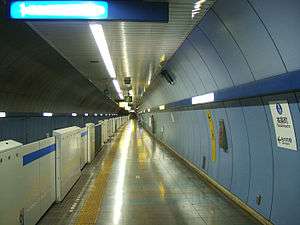
 Platform at Takashimachō Station | |
| Location |
Nishi, Yokohama, Kanagawa (横浜市西区花咲町7丁目41番地) Japan |
| Operated by | Yokohama Municipal Subway |
| Line(s) | Blue Line |
| Other information | |
| Station code | B19 |
| History | |
| Opened | 1914 |
| Traffic | |
| Passengers (2008) | 3,278 daily |
Takashimachō Station (高島町駅 Takashimachō-eki) is a metro station located in Nishi-ku, Yokohama, Kanagawa, Japan operated by the Yokohama Municipal Subway’s Blue Line (Line 3). It is 21.6 kilometers from the terminus of the Blue Line at Shōnandai Station.
History
Takashimachō Station was originally opened as a station on the Keihin Line (presently the Keihin-Tōhoku Line), the first electrified service between Tokyo and Yokohama, on December 20, 1914. The station was renamed Yokohama Station (横浜駅) when services began on the Tōkaidō Main Line on August 15, 1915 with the original Yokohama Station renamed Sakuragichō Station (桜木町駅). The station was connected to the Tokyo Yokohama Railway (present-day Tōkyū Tōyoko Line) on May 18, 1928; however, the Tokyo Yokohama Railway renamed its station Hon-Yokohama Station (本横浜駅) on August 8, 1928. The JNR moved Yokohama Station (and the Tōkaidō Main Line) north to the current location, thereby ending its service here on October 15, 1928, and the station reverted to its original name of Takashimachō Station on January 20, 1931. On September 4, 1976 the underground station for the Yokohama Municipal Subway Line 3 was completed. The above-ground Tōyoko Line ceased operations to this station on January 31, 2004.
Lines
Station layout
Takashimachō Station has a single island platform serving two tracks, located four stories underground.
Platforms
| ■ Blue Line (Yokohama) | Kannai, Totsuka, Shōnandai | |
| ■ Blue Line (Yokohama) | Kannai, Yokohama, Shin-Yokohama, Azamino |
Adjacent stations
| ← | Service | → | ||
|---|---|---|---|---|
| Yokohama Subway Blue Line (B19) | ||||
| Rapid: Does not stop at this station | ||||
| Sakuragichō (B18) | Local | Yokohama (B20) | ||
See also
References
- Harris, Ken and Clarke, Jackie. Jane's World Railways 2008-2009. Jane's Information Group (2008). ISBN 0-7106-2861-7
External links
| Wikimedia Commons has media related to Takashimachō Station. |
- Takashimachō Station (Blue Line) (Japanese)
Coordinates: 35°27′31″N 139°37′26″E / 35.4586°N 139.6239°E