Taliperu Project
| Taliperu Project | |
|---|---|
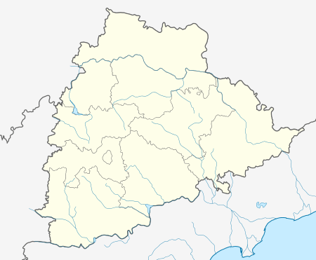 Location of Taliperu Project in India Telangana | |
| Official name |
తాలిపేరు ప్రాజెక్ట్ Taliperu Project |
| Location | Cherla , Khammam District, Telangana, India |
| Coordinates | 18°6′10″N 80°51′55″E / 18.10278°N 80.86528°ECoordinates: 18°6′10″N 80°51′55″E / 18.10278°N 80.86528°E |
| Purpose | Irrigation |
| Status | Operational |
| Opening date | 1985 |
| Construction cost | Rs 52.98 crores |
| Dam and spillways | |
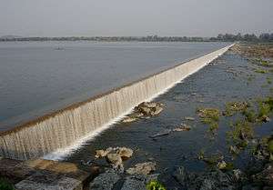
| Type of dam | Earth fill dam |
| Impounds | Taliperu River |
| Height | 25 metres (82 ft) above lowest foundation |
| Length | 2,762 metres (9,062 ft)[1] |
| Spillways | 25 |
| Spillway type | Ogee crest |
| Spillway capacity | 53043 Cusec |
| Reservoir | |
| Creates | Taliperu Reservoir |
| Total capacity | 0.73 Tmcft |
| Active capacity | 0.51 Tmcft |
| Catchment area | 24000 Acres |
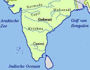
Taliperu Project (Telugu: తాలిపేరు ప్రాజెక్ట్) also known as Taliperu Reservoir is a medium irrigation project constructed across the Taliperu River, a tributory of Godavari River, located at Cherla Village and Mandal, Khammam District, Telangana. This project utilizes about 5.0 TMC of water and creates 24500 Acres of Ayacut in both Cherla and Dummugudem Mandals, Khammam District.[2]
See also
- Sriram Sagar Project
- Sripada Yellampalli project
- Nizam Sagar
- Kaddam Project
- Pranahita Chevella
- Alisagar lift irrigation scheme
- Sri Komaram Bheem Project
- Icchampally Project
- Lower Manair Dam
- Mid Manair Dam
- Upper Manair Dam
References
- ↑ "India: National Register of Large Dams 2012" (PDF). Central Water Commission. Retrieved 26 August 2014.
- ↑ "Taliperu Dam D02295". Retrieved 26 August 2015.
This article is issued from Wikipedia - version of the 5/18/2016. The text is available under the Creative Commons Attribution/Share Alike but additional terms may apply for the media files.