Talmage, Utah
| Talmage, Utah | |
|---|---|
| Unincorporated community | |
 Talmage Location within the state of Utah | |
| Coordinates: 40°20′24″N 110°25′39″W / 40.34000°N 110.42750°WCoordinates: 40°20′24″N 110°25′39″W / 40.34000°N 110.42750°W | |
| Country | United States |
| State | Utah |
| County | Duchesne |
| Settled | 1907 |
| Named for | James E. Talmage |
| Elevation | 6,834 ft (2,083 m) |
| Time zone | Mountain (MST) (UTC-7) |
| • Summer (DST) | MDT (UTC-6) |
| ZIP codes | 84073 |
| Area code(s) | 435 |
| GNIS feature ID | 1433175[1] |
| Historical population | |||
|---|---|---|---|
| Census | Pop. | %± | |
| 1920 | 295 | — | |
| 1930 | 222 | −24.7% | |
| 1940 | 195 | −12.2% | |
| 1950 | 174 | −10.8% | |
| Source: U.S. Census Bureau[2] | |||
Talmage is an unincorporated community in Duchesne County, Utah, United States. Its elevation is 6,834 feet (2,083 m).[1] Although Talmage is unincorporated, it has a post office, with the ZIP code of 84073.[3]
The town was founded in 1907 and named Winn in 1912, but renamed in 1914 to honor Latter-day Saint leader James E. Talmage.[4]
History
The Talmage Post Office, which was hosted in a small bedroom in the home of long-time postmaster Warner Nielsen, closed after his death in 2003.
Climate
According to the Köppen Climate Classification system, Talmage has a semi-arid climate, abbreviated "BSk" on climate maps.[5]
References
- 1 2 "Talmage, Utah". Geographic Names Information System. United States Geological Survey. Retrieved 2008-04-12.
- ↑ "Census of Population and Housing". U.S. Census Bureau. Retrieved November 7, 2011.
- ↑ Zip Code Lookup
- ↑ Van Cott, John W. (1990). Utah Place Names. Salt Lake City: University of Utah Press. p. 364. ISBN 0-87480-345-4.
- ↑ Climate Summary for Talmage, Utah
Municipalities and communities of Duchesne County, Utah, United States | ||
|---|---|---|
| Cities | 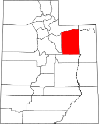 | |
| Towns | ||
| CDPs | ||
| Unincorporated communities | ||
| Indian reservation | ||
| Ghost town | ||
| Footnotes | ‡This populated place also has portions in an adjacent county or counties | |
This article is issued from Wikipedia - version of the 7/30/2016. The text is available under the Creative Commons Attribution/Share Alike but additional terms may apply for the media files.