Teigen, Montana
| Teigen | |
|---|---|
| Unincorporated community | |
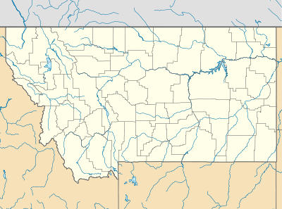 Teigen Location within the state of Montana | |
| Coordinates: 47°2′12″N 108°35′48″W / 47.03667°N 108.59667°WCoordinates: 47°2′12″N 108°35′48″W / 47.03667°N 108.59667°W | |
| Country | United States |
| State | Montana |
| County | Petroleum |
| Elevation | 3,192 ft (973 m) |
| Time zone | Mountain (MST) (UTC-7) |
| • Summer (DST) | MDT (UTC-6) |
| ZIP codes | 59084 |
| GNIS feature ID | 777448[1] |
Teigen was an unincorporated community in western Petroleum County, Montana, United States, stretching along Highway 200 west of the town of Winnett, the county seat of Petroleum County.[2] Its elevation was 3,192 feet (973 m).[1] Teigen's post office opened on November 24, 1914, but although the post office was closed on December 21, 1983,[3] the community still has a separate ZIP code of 59084.[4]
Climate
According to the Köppen Climate Classification system, Teigen has a semi-arid climate, abbreviated "BSk" on climate maps.[5]
References
- 1 2 "Teigen, Montana". Geographic Names Information System. United States Geological Survey.
- ↑ Rand McNally. The Road Atlas '08. Chicago: Rand McNally, 2008, p. 61.
- ↑ U.S. Geological Survey Geographic Names Information System: Teigen Post Office
- ↑ Zip Code Lookup
- ↑ Climate Summary for Teigen, Montana
Municipalities and communities of Petroleum County, Montana, United States | ||
|---|---|---|
| Town | 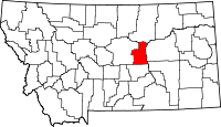 | |
| Unincorporated communities | ||
This article is issued from Wikipedia - version of the 8/4/2015. The text is available under the Creative Commons Attribution/Share Alike but additional terms may apply for the media files.