Tepanjski Vrh
| Tepanjski Vrh | |
|---|---|
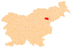
 Tepanjski Vrh Location in Slovenia | |
| Coordinates: 46°20′46.64″N 15°27′23.1″E / 46.3462889°N 15.456417°ECoordinates: 46°20′46.64″N 15°27′23.1″E / 46.3462889°N 15.456417°E | |
| Country |
|
| Traditional region | Styria |
| Statistical region | Savinja |
| Municipality | Slovenske Konjice |
| Area | |
| • Total | 0.43 km2 (0.17 sq mi) |
| Elevation | 355.3 m (1,165.7 ft) |
| Population (2002) | |
| • Total | 126 |
| [1] | |
Tepanjski Vrh (pronounced [ˈteːpanski ˈvəɾx]) is a settlement west of Tepanje in the Municipality of Slovenske Konjice in eastern Slovenia. The area is part of the traditional region of Styria and is now included in the Savinja Statistical Region.[2]
References
External links
| Settlements | Administrative centre: Slovenske Konjice
|  |
|---|---|---|
| Landmarks |
| |
| Notable people |
| |
This article is issued from Wikipedia - version of the 2/8/2015. The text is available under the Creative Commons Attribution/Share Alike but additional terms may apply for the media files.