Spodnje Grušovje
| Spodnje Grušovje | |
|---|---|
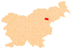
 Spodnje Grušovje Location in Slovenia | |
| Coordinates: 46°20′46.3″N 15°30′2.12″E / 46.346194°N 15.5005889°ECoordinates: 46°20′46.3″N 15°30′2.12″E / 46.346194°N 15.5005889°E | |
| Country |
|
| Traditional region | Styria |
| Statistical region | Savinja |
| Municipality | Slovenske Konjice |
| Area | |
| • Total | 2.83 km2 (1.09 sq mi) |
| Elevation | 339.5 m (1,113.8 ft) |
| Population (2002) | |
| • Total | 192 |
| [1] | |
Spodnje Grušovje (pronounced [ˈspoːdnjɛ ˈɡɾuːʃɔu̯jɛ]) is a settlement in the Municipality of Slovenske Konjice in eastern Slovenia. The area is part of the traditional region of Styria. The municipality is now included in the Savinja Statistical Region. The A1 Slovenian motorway runs through the settlement.[2]
A Roman-era mansio known as Mansio Ragando on the road from Celeia to Poetovio has been identified in the settlement.[3]
References
External links
| Settlements | Administrative centre: Slovenske Konjice
|  |
|---|---|---|
| Landmarks |
| |
| Notable people |
| |
This article is issued from Wikipedia - version of the 7/31/2016. The text is available under the Creative Commons Attribution/Share Alike but additional terms may apply for the media files.