Throop, Pennsylvania
| Borough of Throop | |
| Settlement | |
 | |
| Motto: "A Great Place to Live!" | |
| Country | United States |
|---|---|
| State | Pennsylvania |
| County | Lackawanna |
| Elevation | 846 ft (257.9 m) |
| Coordinates | 41°26′44″N 75°36′52″W / 41.44556°N 75.61444°WCoordinates: 41°26′44″N 75°36′52″W / 41.44556°N 75.61444°W |
| Area | 5.0 sq mi (12.9 km2) |
| - land | 5.0 sq mi (13 km2) |
| - water | 0.0 sq mi (0 km2), 0% |
| Population | 4,088 (2010) |
| Density | 817.6/sq mi (315.7/km2) |
| Timezone | EST (UTC-5) |
| - summer (DST) | EDT (UTC-4) |
| Zip Code | 18512 |
| Area code | 570 |
 Location of Throop in Pennsylvania | |
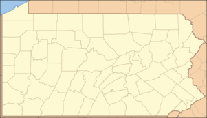
 Location of Pennsylvania in the United States | |
| Website: http://www.throopboro.com/ | |
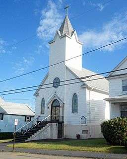
Throop /ˈtruːp/ is a borough in Lackawanna County, Pennsylvania, adjoining Scranton. Formerly, coal mining and silk manufacturing provided employment for the people of Throop, who numbered 2,204 in 1900 and 5,133 in 1910. In 1940, 7,382 people lived in Throop, Pennsylvania. The population was 4,088 at the 2010 census.
Geography
Throop is located at 41°26′44″N 75°36′52″W / 41.44556°N 75.61444°W (41.445536, -75.614494).[1]
According to the United States Census Bureau, the borough has a total area of 5.0 square miles (13 km2), all of it land. Its border meets neighboring towns, including: Olyphant, Dickson City, Dunmore, and Scranton.
History & Notable Features
On April 7, 1911, a fire at the Price-Pancoast Colliery killed 72 coal miners in what has been described as "the most appalling mine disaster in the history of the northern anthracite coal fields". "History of Borough of Throop
The borough contains a lead-contaminated parcel of land commonly known as the Marjol Battery site. Now owned by Gould Electronics, the empty land was a former battery processing facility closed in April 1982. Since the late 1980s, the federal United States Environmental Protection Agency and the state DEP have worked to clean up contamination in adjacent areas, but a final remedy for the site itself has remained on hold in recent years, as local officials and citizens fight with the government agencies and Gould over the best solution. In the meantime, the landowner has maintained a policy of basic containment and monitoring.
Throop's most popular summertime event is its annual Cow Flop organized by the Throop Booster Club. It has been a tradition in Throop since the late 1980s. The Flop serves as a fundraiser for the club and usually raises about $10,000 annually to benefit youth baseball and softball programs in the borough. The Flop, formerly held on a Sunday in late June, is now a two-day (since 2007) event that features a parade, fireworks, music, food, and other entertainment. The event requires more than 100 volunteers, mostly members of the Booster Club and parents of throop athletes, to produce. The main event of the Cow Flop is the raffle involving 2,000 squares and a cow's pick as to where she will relieve herself. Raffle tickets are $10 and the winner of the annual Flop raffle wins $5,000.[2]
Demographics
| Historical population | |||
|---|---|---|---|
| Census | Pop. | %± | |
| 1900 | 2,204 | — | |
| 1910 | 5,133 | 132.9% | |
| 1920 | 6,672 | 30.0% | |
| 1930 | 8,027 | 20.3% | |
| 1940 | 7,382 | −8.0% | |
| 1950 | 5,861 | −20.6% | |
| 1960 | 4,732 | −19.3% | |
| 1970 | 4,307 | −9.0% | |
| 1980 | 4,166 | −3.3% | |
| 1990 | 4,070 | −2.3% | |
| 2000 | 4,010 | −1.5% | |
| 2010 | 4,088 | 1.9% | |
| Est. 2015 | 3,960 | [3] | −3.1% |
| Sources:[4][5][6] | |||
As of the census[7] of 2010, there were 4,088 people, 1,778 households, and 1,122 families residing in the borough. The population density was 817.6 people per square mile (315.7/km²). There were 1,937 housing units at an average density of 387.4 per square mile (151.3/km²). The racial makeup of the borough was 96% White, 1.2% African American, 0.2% American Indian, 0.6% Asian, 0.7% from other races, and 1.2% from two or more races. Hispanic or Latino of any race were 2% of the population.
There were 1,778 households, out of which 23.5% had children under the age of 18 living with them, 43.5% were married couples living together, 13.5% had a female householder with no husband present, and 36.9% were non-families. 31.8% of all households were made up of individuals, and 12.2% had someone living alone who was 65 years of age or older. The average household size was 2.30 and the average family size was 2.89.
In the borough the population was spread out, with 19.2% under the age of 18, 63.2% from 18 to 64, and 17.6% who were 65 years of age or older. The median age was 42.4 years.
The median income for a household in the borough was $34,389, and the median income for a family was $38,929. Males had a median income of $30,254 versus $21,275 for females. The per capita income for the borough was $16,998. About 7.9% of families and 10.5% of the population were below the poverty line, including 22.1% of those under age 18 and 7.5% of those age 65 or over.
Economy
In 1987, the Keystone Sanitary Landfill in Dunmore, Lackawanna County the largest landfill in the state of Pennsylvania,[8] reached capacity and was extended to Throop.[9]
Education

Throop is part of the Mid Valley School District, which serves students from Throop, Olyphant, and Dickson City. The district's two schools, Mid Valley Secondary Center and Mid Valley Elementary Center, are in Throop. In 2014, the Mid Valley School District's enrollment was 1,752 students.[10] In 2013, the Pittsburgh Business Times ranked Mid Valley School District 360th out of 496 public schools for academic achievement of its pupils. According to an Institute for Public Policy & Economic Development Report, in 2008, the academic achievement in reading and mathematics of Mid Valley School District students was the lowest among all Lackawanna County public school districts.[11] Additionally, the Institute found that Mid Valley students performed poorly on the state's writing tests. The students scores were below county averages for four school years (2006-2009) for 5th, 8th and 11th graders.[12]
Government
Throop's government consists of one elected mayor and seven elected council members. The current mayor is Wayne Williams. The current council members are John Musewicz, Tom Lukasewicz, David Repchick, Neil Furiosi, Anthony Gangemi, Charlene De Pasquale Tomasovitch and Mark Mazak.
In 2015, borough officials are embroiled in a protracted dispute with a Pennsylvania journal over open records request. Questions have arisen over the borough council employing relatives and refusing to release public records related to hirings and salaries.[13]
Roads
In the Throop area, Interstate 81 is the main highway. Interstate 84, Interstate 380. and U.S. Route 6 meet I-81 at the Throop Dunmore Interchange in Dunmore near Throop.
References
- ↑ "US Gazetteer files: 2010, 2000, and 1990". United States Census Bureau. 2011-02-12. Retrieved 2011-04-23.
- ↑ http://www.thetimes-tribune.com/articles/2008/06/29/top_local_stories/19813866.txt Retrieved 2009/13/03.
- ↑ "Annual Estimates of the Resident Population for Incorporated Places: April 1, 2010 to July 1, 2015". Retrieved July 2, 2016.
- ↑ "Census of Population and Housing". U.S. Census Bureau. Retrieved 11 December 2013.
- ↑ "American FactFinder". United States Census Bureau. Retrieved 2008-01-31.
- ↑ "Incorporated Places and Minor Civil Divisions Datasets: Subcounty Resident Population Estimates: April 1, 2010 to July 1, 2012". Population Estimates. U.S. Census Bureau. Retrieved 11 December 2013.
- ↑ "American FactFinder". United States Census Bureau. Retrieved 2011-05-14.
- ↑ A timeline of events Friends of Lackawanna.org, undated, retrieved 8 October 2015
- ↑ 1045 Sharon Soltis-Sparano Pennsylvania State Ethics Commission, page 33 of 39, 20 February 1997
- ↑ Pennsylvania Department of Education (October 4, 2013). "District Fast Facts - Mid Valley School District".
- ↑ Education Lackawanna and Luzerne County Indicators Report, The Institute, May 2009
- ↑ The Institute for Public Policy and Economic Development (2010). "Lackawanna County School Assessment Report - Writing Achievement" (PDF).
- ↑ Andrew Staub (April 22, 2015). "Throop turns request for salary data into open-records battle". PA Independent.
Municipalities and communities of Lackawanna County, Pennsylvania, United States | ||
|---|---|---|
| Cities | 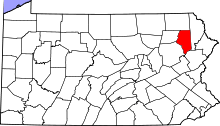 | |
| Boroughs | ||
| Townships | ||
| CDPs | ||
| Unincorporated communities |
| |