Timms Hill
| Timms Hill | |
|---|---|
|
Timms Hill, Wisconsin, July 2014. | |
| Highest point | |
| Elevation | 1,951.5 ft (594.8 m) [1] |
| Prominence | 425 ft (130 m) [2] |
| Listing | U.S. state high point 39th |
| Coordinates | 45°27′03″N 90°11′43″W / 45.450884317°N 90.195397889°WCoordinates: 45°27′03″N 90°11′43″W / 45.450884317°N 90.195397889°W [1] |
| Geography | |
 Timms Hill Wisconsin | |
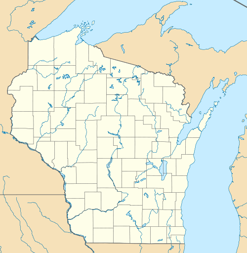
| Location | Price County, Wisconsin, US |
| Topo map | USGS Timms Hill |
| Climbing | |
| Easiest route | Hike |
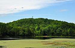
Timms Hill is the highest natural point in the U.S. state of Wisconsin. Located in north-central Wisconsin in Timms Hill County Park in the Town of Hill in Price County, Timms Hill has an elevation of 1,951.5 ft (595 m). It is less than 1 mile (1.6 km) south of Highway 86, about midway between Ogema and Spirit and about 23 miles (37 km) west of Tomahawk.
A public lookout tower on top offers outstanding views of the surrounding area. Visible to the southeast is Rib Mountain (elev. 1,924 ft, 586 m), 44 miles away by line of sight.
The ten-mile Timms Hill Trail connects to the Ice Age Trail,[3] a National Scenic Trail stretching 1,200 miles (1,900 km) across glacial terrain in Wisconsin.

The tower at the top of Timms Hill.
See also
References
- 1 2 "Ogema". NGS data sheet. U.S. National Geodetic Survey. Retrieved 2010-01-26.
- ↑ "Timms Hill, Wisconsin". Peakbagger.com. Retrieved 2012-10-17.
- ↑ Timm's Hill Trail Web Site
External links
- "Timms Hill". Geographic Names Information System. United States Geological Survey. Retrieved 2008-12-18.
- "Timms Hill, WI". TopoQuest Topographic Map Viewer. Retrieved 2008-12-18.
- "Timms Hill". SummitPost.org. Retrieved 2008-12-18.
This article is issued from Wikipedia - version of the 11/4/2016. The text is available under the Creative Commons Attribution/Share Alike but additional terms may apply for the media files.