Humphreys Peak
| Humphreys Peak | |
|---|---|
| Navajo: Doko'o'osliid | |
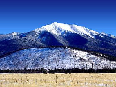 Humphreys Peak in winter 2004 | |
| Highest point | |
| Elevation | 12,637 ft (3,852 m) NAVD 88[1] |
| Prominence | 6,039 ft (1,841 m) [2] |
| Listing | |
| Coordinates | 35°20′47″N 111°40′41″W / 35.346341917°N 111.677945539°WCoordinates: 35°20′47″N 111°40′41″W / 35.346341917°N 111.677945539°W [1] |
| Geography | |
 Humphreys Peak
| |
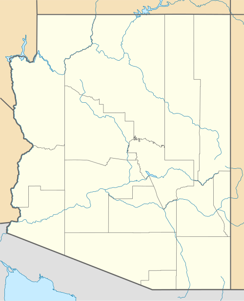
| Location | Coconino County, Arizona, U.S. |
| Parent range | San Francisco Peaks |
| Topo map | USGS Humphreys Peak |
| Geology | |
| Mountain type | igneous, volcanic |
| Volcanic field | San Francisco volcanic field |
| Climbing | |
| Easiest route | Humphreys Trail, class 1[4] |
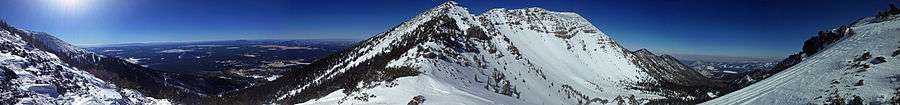
Humphreys Peak (Hopi: Aaloosaktukwi, Navajo: Dookʼoʼoosłííd) is the highest natural point in the U.S. state of Arizona,[5] with an elevation of 12,637 feet (3,852 m)[1] and is located within the Kachina Peaks Wilderness in the Coconino National Forest, about 11 miles (17.7 km) north of Flagstaff, Arizona. Humphreys Peak is the highest of a group of extinct volcanic peaks known as the San Francisco Peaks.
The summit can be most easily reached by hiking the 4.8 miles (7.7 km) long Humphreys Summit Trail that begins at the Arizona Snowbowl ski resort in the Coconino National Forest.[4]
Humphreys Peak was named in about 1870 for General Andrew A. Humphreys, a U.S. Army officer who was a Union general during the American Civil War, and who later became Chief of Engineers of the United States Army Corps of Engineers. However, a General Land Office map from 1903 showed the name San Francisco Peak applied to this feature (apparently borrowed from San Francisco Mountain on which the peak stands). Thus the United States Board on Geographic Names approved the variant name in 1911. In 1933, the application of the names was rectified.[6]
See also
- List of U.S. states by elevation
- List of Ultras of the United States
- List of mountains and hills of Arizona by height
- San Francisco Peaks
References
- 1 2 3 "Frisco". NGS data sheet. U.S. National Geodetic Survey. Retrieved November 13, 2008.
- ↑ "Humphreys Peak, Arizona". Peakbagger.com. Retrieved November 13, 2008.
- ↑ "United States State High Points (plus DC)". Peakbagger.com. Retrieved 2016-08-17.
- 1 2 "Humphreys Trail #51". Coconino National Forest, U.S. Forest Service. Retrieved February 4, 2014.
- ↑ "Elevations and Distances in the United States". United States Geological Survey. April 29, 2005. Retrieved March 29, 2009.
- ↑ "Humphreys Peak". Geographic Names Information System. United States Geological Survey. Retrieved November 13, 2008.
External links
| Wikimedia Commons has media related to Humphrey's Peak. |
- "Humphreys Peak". SummitPost.org.
- "The peaks cam project". U.S. Forest Service.
- "Kachina Trail #150". U.S. Forest Service.
- "Humphreys Peak Trail #151." HikeArizona.com.
- "Kachina Peaks Wilderness." U.S. Forest Service.