Townville, Pennsylvania
| Townville, Pennsylvania | |
|---|---|
| Borough | |
 Location of Townville in Crawford County | |
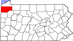
 Townville Location of Townville in Pennsylvania | |
| Coordinates: 41°40′47″N 79°52′54″W / 41.67972°N 79.88167°WCoordinates: 41°40′47″N 79°52′54″W / 41.67972°N 79.88167°W | |
| Country | United States |
| State | Pennsylvania |
| County | Crawford County |
| Founded | 1831 |
| Area | |
| • Total | 0.51 sq mi (1.33 km2) |
| • Land | 0.51 sq mi (1.33 km2) |
| • Water | 0.0 sq mi (0.0 km2) |
| Elevation | 1,411 ft (430 m) |
| Population (2010) | |
| • Total | 323 |
| • Density | 628/sq mi (242.6/km2) |
| Time zone | EST (UTC-4) |
| • Summer (DST) | EDT (UTC-5) |
| Area code(s) | 814 |
Townville is a borough in Crawford County, Pennsylvania, United States. The population was 323 at the 2010 census.[1] It was established in 1831.
Geography
Townville is located in eastern Crawford County at 41°40′47″N 79°52′54″W / 41.67972°N 79.88167°W (41.679679, -79.881731).[2] It is surrounded by Steuben Township, a separate municipality.
Pennsylvania Route 408 passes through the borough, leading east 8 miles (13 km) to Hydetown and northwest 14 miles (23 km) to Cambridge Springs. Meadville, the county seat, is 15 miles (24 km) to the west of Townville via PA 408, Lyona Road, and PA 77.
According to the United States Census Bureau, Townville has a total area of 0.51 square miles (1.33 km2), all of it land.[1] The borough is in a valley at the height of land between north-flowing Muddy Creek and south-flowing Sugar Creek, both tributaries of French Creek and part of the Allegheny River watershed.
Demographics
| Historical population | |||
|---|---|---|---|
| Census | Pop. | %± | |
| 1860 | 132 | — | |
| 1870 | 280 | 112.1% | |
| 1880 | 610 | 117.9% | |
| 1890 | 358 | −41.3% | |
| 1900 | 327 | −8.7% | |
| 1910 | 317 | −3.1% | |
| 1920 | 272 | −14.2% | |
| 1930 | 269 | −1.1% | |
| 1940 | 294 | 9.3% | |
| 1950 | 351 | 19.4% | |
| 1960 | 361 | 2.8% | |
| 1970 | 349 | −3.3% | |
| 1980 | 364 | 4.3% | |
| 1990 | 358 | −1.6% | |
| 2000 | 306 | −14.5% | |
| 2010 | 323 | 5.6% | |
| Est. 2015 | 318 | [3] | −1.5% |
| Sources:[4][5][6] | |||
As of the census[5] of 2000, there were 306 people, 119 households, and 94 families residing in the borough. The population density was 535.3 people per square mile (207.3/km²). There were 125 housing units at an average density of 218.7 per square mile (84.7/km²). The racial makeup of the borough was 99.02% White, 0.33% Asian, 0.33% from other races, and 0.33% from two or more races. Hispanic or Latino of any race were 0.33% of the population.
There were 119 households, out of which 34.5% had children under the age of 18 living with them, 70.6% were married couples living together, 7.6% had a female householder with no husband present, and 20.2% were non-families. 17.6% of all households were made up of individuals, and 7.6% had someone living alone who was 65 years of age or older. The average household size was 2.57 and the average family size was 2.93.
In the borough the population was spread out, with 26.8% under the age of 18, 3.6% from 18 to 24, 27.5% from 25 to 44, 22.5% from 45 to 64, and 19.6% who were 65 years of age or older. The median age was 39 years. For every 100 females there were 97.4 males. For every 100 females age 18 and over, there were 88.2 males.
The median income for a household in the borough was $35,833, and the median income for a family was $37,500. Males had a median income of $30,417 versus $21,458 for females. The per capita income for the borough was $18,095. None of the families and 1.4% of the population were living below the poverty line, including no under eighteens and 3.3% of those over 64.
References
- 1 2 "Geographic Identifiers: 2010 Census Summary File 1 (G001): Townville borough, Pennsylvania". U.S. Census Bureau, American Factfinder. Retrieved June 5, 2015.
- ↑ "US Gazetteer files: 2010, 2000, and 1990". United States Census Bureau. 2011-02-12. Retrieved 2011-04-23.
- ↑ "Annual Estimates of the Resident Population for Incorporated Places: April 1, 2010 to July 1, 2015". Retrieved July 2, 2016.
- ↑ "Census of Population and Housing". U.S. Census Bureau. Retrieved 11 December 2013.
- 1 2 "American FactFinder". United States Census Bureau. Retrieved 2008-01-31.
- ↑ "Incorporated Places and Minor Civil Divisions Datasets: Subcounty Resident Population Estimates: April 1, 2010 to July 1, 2012". Population Estimates. U.S. Census Bureau. Retrieved 11 December 2013.