Tuần Giáo District
| Tuần Giáo District Huyện Tuần Giáo | |
|---|---|
| Rural district | |
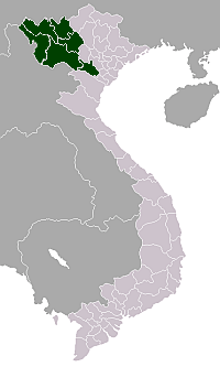
 District location in northern Vietnam | |
| Country |
|
| Region | Northwest |
| Province | Dien Bien |
| Capital | Tuần Giáo |
| Area | |
| • Total | 611 sq mi (1,583 km2) |
| Population (2003) | |
| • Total | 104,185 |
| Time zone | Indochina Time (UTC+07:00) |
Tuần Giáo is a rural district of Điện Biên Province in the Northwest region of Vietnam. As of 2003, the district had a population of 104,185.[1] The district covers an area of 1,583 km². The district capital lies at Tuần Giáo.[1]
Tuần Giáo earthquake 1983-M=6.7 happened in 14 h of the 24th June, 1983, 11 km northeast of the Tuần Giáo Townlet, causing heavy losses to the Tuần Giáo district and surrounding areas. After the event, series of aftershocks occurred. The strongest aftershock occurred in 15th July 1983 in the same place of maximum magnitude M = 5.4.[2]
Administrative divisions
Tuan Giao has 14 administrative units, including 1 town and 13 communes:
References
- 1 2 "Districts of Vietnam". Statoids. Retrieved March 13, 2009.
- ↑ http://idm.gov.vn/nguon_luc/Xuat_ban/2008/b31-32/b220.htm
Coordinates: 21°40′01″N 103°19′59″E / 21.667°N 103.333°E
This article is issued from Wikipedia - version of the 2/6/2016. The text is available under the Creative Commons Attribution/Share Alike but additional terms may apply for the media files.