Twin Lakes, Washington
| Twin Lakes, Washington | |
|---|---|
| Census-designated place | |
 Twin Lakes  Twin Lakes | |
| Coordinates: 48°15′44″N 118°21′32″W / 48.26222°N 118.35889°WCoordinates: 48°15′44″N 118°21′32″W / 48.26222°N 118.35889°W | |
| Country | United States |
| State | Washington |
| County | Pierce |
| Area | |
| • Total | 4.2 sq mi (10.8 km2) |
| • Land | 4.2 sq mi (10.8 km2) |
| • Water | 0.0 sq mi (0.0 km2) |
| Elevation | 2,590 ft (790 m) |
| Population (2010) | |
| • Total | 59 |
| • Density | 14/sq mi (5.5/km2) |
| Time zone | Pacific |
| Area code(s) | 360 |
Twin Lakes is a census-designated place in Ferry County, Washington, United States.
Demographics
In 2010, it had a population of 59.[1] 36 of the inhabitants were male, and 23 were female.[2]
Geography
Twin Lakes is located in southeastern Ferry County at coordinates 48°15′44″N 118°21′32″W, on the east side of North and South Twin Lakes. The lakes' outlet is Cornstalk Creek, which leaves the north end of North Twin Lake and flows east to the Columbia River at Inchelium. Bridge Creek Road leads east 8 miles (13 km) from North Twin Lake to Inchelium and west across Gold Mountain Ridge 22 miles (35 km) to Washington State Route 21 in the Sanpoil River valley.
According to the U.S. Census Bureau, the Twin Lakes CDP has a total area of 4.2 square miles (10.8 km2), all of it land.[1]
References
- 1 2 "Geographic Identifiers: 2010 Demographic Profile Data (G001): Twin Lakes CDP, Washington". U.S. Census Bureau, American Factfinder. Retrieved October 24, 2016.
- ↑ "Twin Lakes, Washington". Retrieved 19 August 2014.
Municipalities and communities of Ferry County, Washington, United States | ||
|---|---|---|
| City | 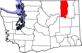 | |
| CDPs | ||
| Other unincorporated communities | ||
| Indian reservation | ||
| Footnotes | ‡This populated place also has portions in an adjacent county or counties | |