Tyler, Minnesota
| Tyler, Minnesota | |
|---|---|
| City | |
 | |
 Location of Tyler within Lincoln County, Minnesota | |
| Coordinates: 44°16′33″N 96°8′0″W / 44.27583°N 96.13333°WCoordinates: 44°16′33″N 96°8′0″W / 44.27583°N 96.13333°W | |
| Country | United States |
| State | Minnesota |
| County | Lincoln |
| Government | |
| • Type | Mayor – Council |
| • Mayor | Mervyn Peterson |
| Area[1] | |
| • Total | 2.01 sq mi (5.21 km2) |
| • Land | 1.97 sq mi (5.10 km2) |
| • Water | 0.04 sq mi (0.10 km2) |
| Elevation | 1,742 ft (531 m) |
| Population (2010)[2] | |
| • Total | 1,143 |
| • Estimate (2012[3]) | 1,122 |
| • Density | 580.2/sq mi (224.0/km2) |
| Time zone | Central (CST) (UTC-6) |
| • Summer (DST) | CDT (UTC-5) |
| ZIP code | 56178 |
| Area code(s) | 507 |
| FIPS code | 27-66046[4] |
| GNIS feature ID | 0658809[5] |
| Website | www.tyler.govoffice.com |
Tyler is a city in Lincoln County, Minnesota, United States. The population was 1,143 at the 2010 census.[6]

History
Tyler was platted in 1879.[7] It was named for C. B. Tyler, a Minnesota land agent and newspaper editor.[8] A post office has been in operation in Tyler since 1879.[9]
Tyler's Danebod district was originally built up chiefly by Danish settlers and is now listed on the U.S. National Register of Historic Places.[10]
Geography
According to the United States Census Bureau, the city has a total area of 2.01 square miles (5.21 km2), of which 1.97 square miles (5.10 km2) is land and 0.04 square miles (0.10 km2) is water.[1]
U.S. Highway 14 serves as a main route in the community.
Demographics
| Historical population | |||
|---|---|---|---|
| Census | Pop. | %± | |
| 1880 | 81 | — | |
| 1890 | 137 | 69.1% | |
| 1900 | 515 | 275.9% | |
| 1910 | 614 | 19.2% | |
| 1920 | 858 | 39.7% | |
| 1930 | 905 | 5.5% | |
| 1940 | 1,005 | 11.0% | |
| 1950 | 1,121 | 11.5% | |
| 1960 | 1,138 | 1.5% | |
| 1970 | 1,069 | −6.1% | |
| 1980 | 1,353 | 26.6% | |
| 1990 | 1,257 | −7.1% | |
| 2000 | 1,218 | −3.1% | |
| 2010 | 1,143 | −6.2% | |
| Est. 2015 | 1,110 | [11] | −2.9% |
| U.S. Decennial Census | |||
2010 census
As of the census[2] of 2010, there were 1,143 people, 520 households, and 292 families residing in the city. The population density was 580.2 inhabitants per square mile (224.0/km2). There were 583 housing units at an average density of 295.9 per square mile (114.2/km2). The racial makeup of the city was 96.9% White, 0.3% African American, 0.3% Native American, 0.2% Asian, 1.0% from other races, and 1.2% from two or more races. Hispanic or Latino of any race were 2.4% of the population.
There were 520 households of which 23.1% had children under the age of 18 living with them, 46.7% were married couples living together, 7.7% had a female householder with no husband present, 1.7% had a male householder with no wife present, and 43.8% were non-families. 40.8% of all households were made up of individuals and 21.4% had someone living alone who was 65 years of age or older. The average household size was 2.10 and the average family size was 2.85.
The median age in the city was 46.1 years. 21.9% of residents were under the age of 18; 5.2% were between the ages of 18 and 24; 22% were from 25 to 44; 24.5% were from 45 to 64; and 26.3% were 65 years of age or older. The gender makeup of the city was 48.1% male and 51.9% female.
2000 census
As of the census[4] of 2000, there were 1,218 people, 532 households, and 338 families residing in the city. The population density was 632.8 people per square mile (244.9/km²). There were 577 housing units at an average density of 299.8 per square mile (116.0/km²). The racial makeup of the city was 97.78% White, 0.49% Native American, 0.49% Asian, 1.23% from other races. Hispanic or Latino of any race were 2.87% of the population.
There were 532 households out of which 24.2% had children under the age of 18 living with them, 56.0% were married couples living together, 6.4% had a female householder with no husband present, and 36.3% were non-families. 33.6% of all households were made up of individuals and 18.4% had someone living alone who was 65 years of age or older. The average household size was 2.20 and the average family size was 2.81.
In the city the population was spread out with 21.3% under the age of 18, 7.2% from 18 to 24, 21.6% from 25 to 44, 22.2% from 45 to 64, and 27.7% who were 65 years of age or older. The median age was 45 years. For every 100 females there were 88.3 males. For every 100 females age 18 and over, there were 84.2 males.
The median income for a household in the city was $31,196, and the median income for a family was $37,841. Males had a median income of $30,592 versus $17,981 for females. The per capita income for the city was $17,451. About 3.8% of families and 6.1% of the population were below the poverty line, including 5.0% of those under age 18 and 14.0% of those age 65 or over.
Tornado
On August 21, 1918, 36 people died when a large tornado tore through Tyler. It was the 4th most deadly tornado in Minnesota history.
On July 1, 2011, a tornado went through Tyler and no deaths or injuries resulted from the tornado. A few homes were considerably damaged.[12]
Annual events
Aebleskiver Days is the yearly town celebration, held on the fourth weekend of July. The event is named after æbleskiver, a spherical, delicious, pancake originating from Denmark. On Saturday evening, they have a parade that goes down main street with floats that are made by the various neighborhoods.
The Lincoln County Fairgrounds are located in Tyler where the yearly county fair takes place in August.
Tyler is home of the Danebod Folk School. Danebod hosts many wonderful programs including annual week-long recreational Family Camps and the Folk Meeting which presents a series of world-renowned lecturers. The entire campus at Danebod including Danebod Lutheran Church has been a part of the National Historic Register since 1975 due to both the architectural and historic significance of the structures within the district.
Early settlers of the Danebod colony (located on the south side of Tyler) founded a residential school in the Danish tradition of Folk High Schools and fostered the concept of "learning for living" by which individuals sought to become enlightened and thoughtful citizens. The Folk School building stands as a testament to these values and continues to serve as a place for fellowship and lifelong learning. Each charming dormitory style room is unique in plan and decoration. A large kitchen and dining area provide a perfect setting for group meals and activities. A lecture hall and several classrooms allow ample space for programming.
References
- 1 2 "US Gazetteer files 2010". United States Census Bureau. Retrieved 2012-11-13.
- 1 2 "American FactFinder". United States Census Bureau. Retrieved 2012-11-13.
- ↑ "Population Estimates". United States Census Bureau. Retrieved 2013-05-28.
- 1 2 "American FactFinder". United States Census Bureau. Retrieved 2008-01-31.
- ↑ "US Board on Geographic Names". United States Geological Survey. 2007-10-25. Retrieved 2008-01-31.
- ↑ "2010 Census Redistricting Data (Public Law 94-171) Summary File". American FactFinder. United States Census Bureau. Retrieved 27 April 2011.
- ↑ Chicago and North Western Railway Company (1908). A History of the Origin of the Place Names Connected with the Chicago & North Western and Chicago, St. Paul, Minneapolis & Omaha Railways. p. 132.
- ↑ Upham, Warren (1920). Minnesota Geographic Names: Their Origin and Historic Significance. Minnesota Historical Society. p. 309.
- ↑ "Lincoln County". Jim Forte Postal History. Retrieved 30 March 2015.
- ↑ "Danebod". MNopedia. Minnesota Historical Society. Retrieved 18 July 2015.
- ↑ "Annual Estimates of the Resident Population for Incorporated Places: April 1, 2010 to July 1, 2015". Retrieved July 2, 2016.
- ↑ Helbling, Audrey Kletscher. "Minnesota Prairie Roots". Minnesota Prairie Roots. Retrieved 9 January 2015.
Municipalities and communities of Lincoln County, Minnesota, United States | ||
|---|---|---|
| Cities | 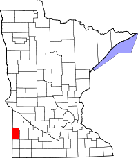 | |
| Townships | ||
| Unincorporated community | ||