Várzea, Praia
.jpg)

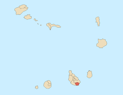
Várzea is the westernmost part of the center of the capital city of Praia in the island of Santiago, Cape Verde. It is the fourth historic area.
Its total area is about 90 to 100 hectares. Buildings and Facilities are in the eastern part while the residential area are in the western part. Its elevations varies from about 5 meters to the east to 30 meters in the west.
Bordering neighbourhoods includes Calabaceira in the north, Platô in the east, Gamboa or Chā das Areias in the south, Terra Branca and Tira Chapeu in the west and Craveiro Lopes to the northeast.


The chief street is an avenue, the Avenida de Cidade de Lisboa (City of Lisbon), a long divided avenue containing 2 lanes and running more than a kilometer long, the main buildings of Várzea are on the avenue. The southern part of the avenue serves as a main route between Praia and Cidade Velha in Ribeira Grande and Porto Mosquito (the EN1-ST2) and the whole as a bypass connector with the route connecting Praia and the north of the island (the EN1-ST1) with a roundabout northeast of the plateau along with the Circular Road, the port and the airport.
History
Early in the 16th century, the low lying areas were forested with kapok trees, they were cut down to make room for farming and agriculture, the forest stretched up to Ribeira Grande. Várzea is the Portuguese word for woodland, a part dominated by a kilometer long and 300 meters wide and covered about 30 hectares. Some portions of the forest were restored mainly with palm in the 18th century and the remainder restored with kapok trees and intermingled with buildings and landmarks built in the 1950s and the mid 20th century, a dense palm grove as they were in the mid-20th century no longer exist. Kapok trees reforested the area and later intermingled the area, until 1998 a part of it remained an open space until another buildings appear, the densest part is to the north.
Agriculture including cattle, tropical fruits and date palm dominate the area. Urbanization started in the 1950s and Estádio da Várzea started to appear. After Cape Verde became independent, the National Assembly Building was built. The National Library of Cape Verde opened its doors in 1999 and is a street north of the stadium,[1] also a monument commemorating Amílcar Cabral is was erected north of the library. The Economic Building was added just south of the outer football (soccer) field in 2013.
About Várzea
The most notable attraction is Estádio da Várzea, a stadium and a sports complex.[2] It is the main home of Académica, Boavista, Desportivo, Sporting, Travadores and Vitória football (soccer) clubs.[3]
Praia's cemetery is in the western part.
One of four variants of tabanka is the Várzea variant common in the neighborhood and used in other parts of the west of the city.[4]
Landmarks and points of interest
- National Assembly Building or the Government Building - south
- National Auditorium, west of the library
- Amílcar Cabral Monument - north of the library
- Estádio da Várzea - east
- National Library of Cape Verde - north[1]
- Economic Building (Caixa Económica de Cabo Verde) - south
- Secundário Conejo Jacinto - secondary school - west
- Várzea tennis courts - westernmost part
Panoramics
It offers the least panoramics other than the Praia area and parts of the south of the island though the island's tallest summit Pico da Antónia are seen.
Transportation
Six transit lines passes through the plateau often or sometimes, the last three do not cross by the Atlantic, they include:[5]
- Achada Mato – Plateau - Meio de Achada
- Palmarejo - Plateau – Achada Grande
- Palmarejo – Plateau – Eugénio Lima
- Terra Branca – Plateau – Pensamento
- São Filipe – Plateau - Achada Santo António - third route crossing inland via Avenida Cidade de Lisboa
- Gamboa – Ponte Vila Nova
References
- 1 2 "About Us". Biblioteca Nacional Cabo Verde. Retrieved 9 November 2013.
- ↑ "Cadeiras começaram a ser colocadas no Estádio da Várzea". A Semana (in Portuguese). 7 May 2011. Retrieved 23 September 2014.
- ↑ "Estádio da Várzea at the Stadium Database homepage".
- ↑ Gonçalves, C. F. (2006). Kab Verd Band.
- ↑ http://www.asemana.publ.cv/spip.php/mes_squelettes/img/spip.php?article94283&ak=1 (Portuguese)
| Neighbourhoods |
|   |
|---|---|---|
| Geographical features | ||
| Major squares | ||
| Major streets and arterials |
| |
| Universities and educational institutions |
| |
| Landmarks and tourism | ||
| Sports facilities and complexes | ||
| Transportation | ||
| Culture |
| |
| History (Timeline) | ||
Coordinates: 14°55′09″N 23°30′38″W / 14.9192°N 23.5106°W