Van Buren Township, Clay County, Indiana
| Van Buren Township | |
|---|---|
| Township | |
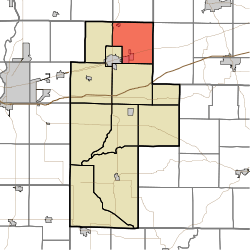 Location of Van Buren Township in Clay County | |
| Coordinates: 39°33′46″N 87°03′38″W / 39.56278°N 87.06056°WCoordinates: 39°33′46″N 87°03′38″W / 39.56278°N 87.06056°W | |
| Country | United States |
| State | Indiana |
| County | Clay |
| Government | |
| • Type | Indiana township |
| Area | |
| • Total | 32.32 sq mi (83.7 km2) |
| • Land | 32.18 sq mi (83.3 km2) |
| • Water | 0.14 sq mi (0.4 km2) |
| Elevation[1] | 682 ft (208 m) |
| Population (2010) | |
| • Total | 3,528 |
| • Density | 109.6/sq mi (42.3/km2) |
| FIPS code | 18-78416[2] |
| GNIS feature ID | 453943 |
Van Buren Township is one of eleven townships in Clay County, Indiana. As of the 2010 census, its population was 3,528 and it contained 1,448 housing units.[3]
History
Van Buren Township was established in the late 1830s. It was named for Martin Van Buren, the ninth Vice President of the United States. There is also a Dick Johnson Township in Clay County in honor of Richard Mentor Johnson, Van Buren's vice president.[4]
Eaglefield Place was listed on the National Register of Historic Places in 1998.[5]
Geography
According to the 2010 census, the township has a total area of 32.32 square miles (83.7 km2), of which 32.18 square miles (83.3 km2) (or 99.57%) is land and 0.14 square miles (0.36 km2) (or 0.43%) is water.[3]
Cities and towns
Unincorporated towns
(This list is based on USGS data and may include former settlements.)
Adjacent townships
- Jackson Township, Parke County (north)
- Madison Township, Putnam County (northeast)
- Washington Township, Putnam County (east)
- Jackson Township (south)
- Brazil Township (southwest)
- Dick Johnson Township (west)
- Raccoon Township, Parke County (northwest)
Major highways
Cemeteries
The township contains five cemeteries: Calcutta, Pell, Pell, Poff and Roberts.
References
- ↑ "US Board on Geographic Names". United States Geological Survey. 2007-10-25. Retrieved 2008-01-31.
- ↑ "American FactFinder". United States Census Bureau. Retrieved 2008-01-31.
- 1 2 "Population, Housing Units, Area, and Density: 2010 - County -- County Subdivision and Place -- 2010 Census Summary File 1". United States Census. Retrieved 2013-05-10.
- ↑ Blanchard, Charles (1884). Counties of Clay and Owen, Indiana: Historical and Biographical. F.A. Battey & Company. p. 83.
- ↑ National Park Service (2010-07-09). "National Register Information System". National Register of Historic Places. National Park Service.
External links
Municipalities and communities of Clay County, Indiana, United States | ||
|---|---|---|
| City | ||
| Towns | ||
| Townships | ||
| CDP | ||
| Other unincorporated communities |
| |
| Ghost towns | ||
| Footnotes | ‡This populated place also has portions in an adjacent county or counties | |