Van Buren Township, Pulaski County, Indiana
| Van Buren Township | |
|---|---|
| Township | |
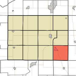 Location in Pulaski County | |
| Coordinates: 40°57′22″N 86°31′48″W / 40.95611°N 86.53000°WCoordinates: 40°57′22″N 86°31′48″W / 40.95611°N 86.53000°W | |
| Country | USA |
| State | Indiana |
| County | Pulaski |
| Government | |
| • Type | Indiana township |
| Area | |
| • Total | 36.28 sq mi (94.0 km2) |
| • Land | 36.28 sq mi (94.0 km2) |
| • Water | 0 sq mi (0 km2) 0% |
| Elevation | 725 ft (221 m) |
| Population (2010) | |
| • Total | 911 |
| • Density | 25.1/sq mi (9.7/km2) |
| ZIP codes | 46978, 46985 |
| GNIS feature ID | 0453951 |
Van Buren Township is one of twelve townships in Pulaski County, Indiana, United States. As of the 2010 census, its population was 911 and it contained 386 housing units.[1]
Van Buren Township was organized in 1842, and named for Martin Van Buren (1782–1862), eighth President of the United States (1837–1841).[2]
Geography
According to the 2010 census, the township has a total area of 36.28 square miles (94.0 km2), all land.[1]
Cities, towns, villages
Unincorporated towns
(This list is based on USGS data and may include former settlements.)
Adjacent townships
- Harrison Township (north)
- Union Township, Fulton County (northeast)
- Wayne Township, Fulton County (east)
- Harrison Township, Cass County (southeast)
- Boone Township, Cass County (south)
- Cass Township, White County (southwest)
- Indian Creek Township (west)
- Monroe Township (northwest)
Cemeteries
The township contains these four cemeteries: Buck, Independent Order of Odd Fellows, Mull and Victor Chapel.
Major highways
School districts
- Eastern Pulaski Community School Corporation
Political districts
- Indiana's 2nd congressional district
- State House District 16
- State Senate District 18
References
- United States Census Bureau 2008 TIGER/Line Shapefiles
- United States Board on Geographic Names (GNIS)
- IndianaMap
- 1 2 "Population, Housing Units, Area, and Density: 2010 - County -- County Subdivision and Place -- 2010 Census Summary File 1". United States Census. Retrieved 2013-05-10.
- ↑ Counties of White and Pulaski, Indiana: Historical and Biographical. F.A. Battey & Company. 1883. p. 588.
External links

Municipalities and communities of Pulaski County, Indiana, United States | ||
|---|---|---|
| Towns | ||
| Townships | ||
| CDP | ||
| Other unincorporated communities |
| |
This article is issued from Wikipedia - version of the 10/20/2016. The text is available under the Creative Commons Attribution/Share Alike but additional terms may apply for the media files.