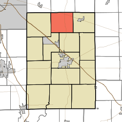
Van Buren Township, Shelby County, Indiana
| Van Buren Township | |
|---|---|
| Township | |
 | |
| Coordinates: 39°39′43″N 85°47′31″W / 39.66194°N 85.79194°WCoordinates: 39°39′43″N 85°47′31″W / 39.66194°N 85.79194°W | |
| Country | United States |
| State | Indiana |
| County | Shelby |
| Government | |
| • Type | Indiana township |
| Area | |
| • Total | 27.91 sq mi (72.3 km2) |
| • Land | 27.9 sq mi (72 km2) |
| • Water | 0.01 sq mi (0.03 km2) |
| Elevation[1] | 837 ft (255 m) |
| Population (2010) | |
| • Total | 1,480 |
| • Density | 53/sq mi (20/km2) |
| FIPS code | 18-78578[2] |
| GNIS feature ID | 453952 |
Van Buren Township is one of fourteen townships in Shelby County, Indiana. As of the 2010 census, its population was 1,480 and it contained 622 housing units.[3]
The township was named for Martin Van Buren, the eighth President of the United States.[4]
Geography
According to the 2010 census, the township has a total area of 27.91 square miles (72.3 km2), of which 27.9 square miles (72 km2) (or 99.96%) is land and 0.01 square miles (0.026 km2) (or 0.04%) is water.[3]
Unincorporated towns
References
- ↑ "US Board on Geographic Names". United States Geological Survey. 2007-10-25. Retrieved 2008-01-31.
- ↑ "American FactFinder". United States Census Bureau. Retrieved 2008-01-31.
- 1 2 "Population, Housing Units, Area, and Density: 2010 - County -- County Subdivision and Place -- 2010 Census Summary File 1". United States Census. Retrieved 2013-05-10.
- ↑ Shelby County, Indiana History & Families. Turner Publishing Company. 1992. p. 172. ISBN 978-1-56311-078-8.
External links
Municipalities and communities of Shelby County, Indiana, United States | ||
|---|---|---|
| City | ||
| Towns | ||
| Townships | ||
| CDP | ||
| Other unincorporated communities |
| |
| Footnotes | ‡This populated place also has portions in an adjacent county or counties | |
This article is issued from Wikipedia - version of the 11/17/2016. The text is available under the Creative Commons Attribution/Share Alike but additional terms may apply for the media files.