Vernonburg, Georgia
| Vernonburg, Georgia | |
|---|---|
| Town | |
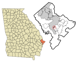 Location in Chatham County and the state of Georgia | |
| Coordinates: 31°58′2″N 81°7′15″W / 31.96722°N 81.12083°WCoordinates: 31°58′2″N 81°7′15″W / 31.96722°N 81.12083°W | |
| Country | United States |
| State | Georgia |
| County | Chatham |
| Area | |
| • Total | 0.4 sq mi (0.9 km2) |
| • Land | 0.4 sq mi (0.9 km2) |
| • Water | 0 sq mi (0 km2) |
| Elevation | 7 ft (2 m) |
| Population (2010) | |
| • Total | 122 |
| • Density | 345/sq mi (153.3/km2) |
| Time zone | Eastern (EST) (UTC-5) |
| • Summer (DST) | EDT (UTC-4) |
| FIPS code | 13-79164[1] |
| GNIS feature ID | 0333326[2] |
Vernonburg is a town in Chatham County, Georgia, about 10 miles south of downtown Savannah. It is located at a sharp curve along the Vernon River, a tidal creek. The population was 122 at the 2010 census. Vernonburg was first settled by German craftsmen in the mid-18th century (hence the German suffix -burg), and was incorporated in 1748. By the early 19th century, the town was becoming a summer community for wealthy Savannahians. Then as now, it was linked to downtown Savannah by White Bluff Road, the 19th-century extension of Bull Street. Today Vernonburg is an attractive residential village with large homes and beautiful landscaped gardens.
Vernonburg is part of the Savannah Metropolitan Statistical Area.
Geography
Vernonburg is located at 31°58′2″N 81°7′14″W / 31.96722°N 81.12056°W (31.967361, -81.12073).[3]
According to the United States Census Bureau, the town has a total area of 0.4 square miles (1.0 km²), of which, 0.4 square miles (0.9 km²) of it is land and 2.70% is water. Vernonburg consists mainly of a small stretch of riverfront properties along a section of the Vernon river.
Demographics
| Historical population | |||
|---|---|---|---|
| Census | Pop. | %± | |
| 1960 | 65 | — | |
| 1970 | 136 | 109.2% | |
| 1980 | 178 | 30.9% | |
| 1990 | 74 | −58.4% | |
| 2000 | 138 | 86.5% | |
| 2010 | 122 | −11.6% | |
| Est. 2015 | 131 | [4] | 7.4% |
As of the census[1] of 2010, there were 122 people, 59 households, and 47 families residing in the town. The population density was 310/sq mi (118/km2). There were 69 housing units at an average density of 173/sq mi (67/km2). The racial makeup of the town was 98.4% White, and 1.6% Asian.
There were 52 households out of which 25.0% had children under the age of 18 living with them, 71.2% were married couples living together, 5.8% had a female householder with no husband present, and 19.2% were non-families. 19.2% of all households were made up of individuals and 13.5% had someone living alone who was 65 years of age or older. The average household size was 2.35 and the average family size was 2.67.
In the town the population was spread out with 21.3% under the age of 18, 4.1% from 18 to 24, 16.4% from 25 to 44, 33.6% from 45 to 64, and 24.6% who were 65 years of age or older. The median age was 51.0 years. For every 100 females there were 87.7 males.
The median income for a household in the town was $74,375, and the median income for a family was $158,125. Males had a median income of $161,667 versus $150,313 for females. The per capita income for the town was $91,121. 4.6% of the population and none of the families were below the poverty line.
References
- 1 2 "American FactFinder". United States Census Bureau. Retrieved 2008-01-31.
- ↑ "US Board on Geographic Names". United States Geological Survey. 2007-10-25. Retrieved 2008-01-31.
- ↑ "US Gazetteer files: 2010, 2000, and 1990". United States Census Bureau. 2011-02-12. Retrieved 2011-04-23.
- ↑ "Annual Estimates of the Resident Population for Incorporated Places: April 1, 2010 to July 1, 2015". Retrieved July 2, 2016.
- ↑ "Census of Population and Housing". Census.gov. Archived from the original on May 11, 2015. Retrieved June 4, 2015.
Municipalities and communities of Chatham County, Georgia, United States | ||
|---|---|---|
| Cities |  | |
| Towns | ||
| CDPs | ||
| Unincorporated communities | ||