Victory, Cayuga County, New York
| Victory, New York | |
|---|---|
| Town | |
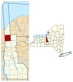 Location within Cayuga County and New York | |
 Victory Location in the state of New York | |
| Coordinates: 43°11′50″N 76°39′16″W / 43.19722°N 76.65444°W | |
| Country | United States |
| State | New York |
| County | Cayuga |
| Government | |
| • Type | Town Council |
| • Town Supervisor | Robert R. Ingham (R) |
| • Town Council |
Members' List
|
| Area | |
| • Total | 34.45 sq mi (89.23 km2) |
| • Land | 34.39 sq mi (89.08 km2) |
| • Water | 0.06 sq mi (0.15 km2) |
| Elevation | 431 ft (131 m) |
| Population (2010) | |
| • Total | 1,660 |
| • Density | 48.3/sq mi (18.6/km2) |
| Time zone | Eastern (EST) |
| ZIP code | 14564 |
| FIPS code | 36-011-77420 |
| Website |
www |
Victory is a town in Cayuga County, New York, United States. The population was 1,660 at the 2010 census.[1] The name celebrates the political victory in forming the town. It is in the northwestern part of the county and north of Auburn.
History
Victory was within the Central New York Military Tract. The town was first settled around 1799.
The town was formed from the town of Cato in 1821 after a bitter political dispute about whether to break up Cato. The town of Conquest was formed at the same time and also given a name celebrating the split.
Geography
According to the United States Census Bureau, Victory has a total area of 34.4 square miles (89.2 km2), of which 34.4 square miles (89.1 km2) is land and 0.08 square miles (0.2 km2), or 0.17%, is water.[1]
The west town line is the border of Wayne County.
Sterling Creek flows northward through the town toward Lake Ontario.
New York State Route 38 intersects New York State Route 370 by Victory village. New York State Route 104 runs along the north town line.
Demographics
| Historical population | |||
|---|---|---|---|
| Census | Pop. | %± | |
| 1830 | 1,819 | — | |
| 1840 | 2,371 | 30.3% | |
| 1850 | 2,298 | −3.1% | |
| 1860 | 2,077 | −9.6% | |
| 1870 | 1,898 | −8.6% | |
| 1880 | 1,952 | 2.8% | |
| 1890 | 1,706 | −12.6% | |
| 1900 | 1,398 | −18.1% | |
| 1910 | 1,208 | −13.6% | |
| 1920 | 1,078 | −10.8% | |
| 1930 | 1,037 | −3.8% | |
| 1940 | 1,152 | 11.1% | |
| 1950 | 1,154 | 0.2% | |
| 1960 | 1,159 | 0.4% | |
| 1970 | 1,251 | 7.9% | |
| 1980 | 1,519 | 21.4% | |
| 1990 | 1,535 | 1.1% | |
| 2000 | 1,838 | 19.7% | |
| 2010 | 1,660 | −9.7% | |
| Est. 2014 | 1,623 | [2] | −2.2% |
As of the census[4] of 2000, there were 1,838 people, 617 households, and 481 families residing in the town. The population density was 53.5 people per square mile (20.6/km²). There were 662 housing units at an average density of 19.3 per square mile (7.4/km²). The racial makeup of the town was 97.17% White, 0.38% African American, 0.87% Native American, 0.16% Asian, 0.27% Pacific Islander, 0.11% from other races, and 1.03% from two or more races. Hispanic or Latino of any race were 0.44% of the population.
There were 617 households out of which 43.1% had children under the age of 18 living with them, 63.2% were married couples living together, 7.1% had a female householder with no husband present, and 22.0% were non-families. 18.2% of all households were made up of individuals and 6.0% had someone living alone who was 65 years of age or older. The average household size was 2.98 and the average family size was 3.36.
In the town the population was spread out with 32.0% under the age of 18, 7.3% from 18 to 24, 31.9% from 25 to 44, 20.9% from 45 to 64, and 7.8% who were 65 years of age or older. The median age was 34 years. For every 100 females there were 104.2 males. For every 100 females age 18 and over, there were 107.6 males.
The median income for a household in the town was $38,672, and the median income for a family was $41,680. Males had a median income of $32,232 versus $23,150 for females. The per capita income for the town was $15,462. About 7.9% of families and 10.6% of the population were below the poverty line, including 15.7% of those under age 18 and 8.1% of those age 65 or over.
Communities and locations in Victory
- Ira Corners – A location on the east town line.
- K Cat Corners A location in the east part of the town, northeast of Victory village.
- North Victory – A hamlet near the north town line (mostly in the town of Sterling) on NY-104. It was settled around 1812.
- Victory – The hamlet of Victory at the junction of Routes NY-38 and NY-370 near the center of the town. The community was settled around 1806.
- Westbury – A hamlet on the west town line, partly in Wayne County. It was first settled around 1806.
References
- 1 2 "Geographic Identifiers: 2010 Demographic Profile Data (G001): Victory town, Cayuga County, New York". U.S. Census Bureau, American Factfinder. Retrieved November 14, 2014.
- ↑ "Annual Estimates of the Resident Population for Incorporated Places: April 1, 2010 to July 1, 2014". Retrieved June 4, 2015.
- ↑ "Census of Population and Housing". Census.gov. Retrieved June 4, 2015.
- ↑ "American FactFinder". United States Census Bureau. Retrieved 2008-01-31.
External links
Coordinates: 43°11′50″N 76°39′16″W / 43.19722°N 76.65444°W
Municipalities and communities of Cayuga County, New York, United States | ||
|---|---|---|
| City | 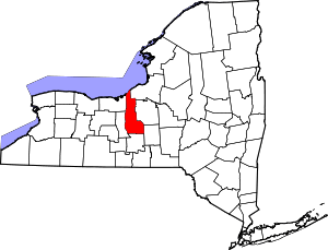 | |
| Towns | ||
| Villages | ||
| CDP | ||
| Other hamlets | ||
| Footnotes | ‡This populated place also has portions in an adjacent county or counties | |