Vidrga
| Vidrga | |
|---|---|
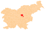
 Vidrga Location in Slovenia | |
| Coordinates: 46°8′6.2″N 14°51′34.47″E / 46.135056°N 14.8595750°ECoordinates: 46°8′6.2″N 14°51′34.47″E / 46.135056°N 14.8595750°E | |
| Country |
|
| Traditional region | Upper Carniola |
| Statistical region | Central Sava |
| Municipality | Zagorje ob Savi |
| Area | |
| • Total | 0.99 km2 (0.38 sq mi) |
| Elevation | 430.4 m (1,412.1 ft) |
| Population (2002) | |
| • Total | 97 |
| [1] | |
Vidrga (pronounced [ˈʋiːdəɾga]; in older sources also Viderga[2]) is a small settlement in the Municipality of Zagorje ob Savi in central Slovenia. It lies north of Vače on the main road from Moravče to Izlake. The area is part of the traditional region of Upper Carniola. It is now included with the rest of the municipality in the Central Sava Statistical Region.[3]
Name
The name Vidrga is believed to be derived from a pre-Slavic hydronym etymologically related to Idrija with a prothetic -v.[4]
History
Vidrga was a hamlet of Kandrše until 1998, when it was separated from it and made a separate village.[5]
References
- ↑ Statistical Office of the Republic of Slovenia
- ↑ Krajevni leksikon Dravske Banovine. 1937. Ljubljana: Zveza za tujski promet za Slovenijo, p. 326.
- ↑ Zagorje ob Savi municipal site
- ↑ Bezlaj, France. 1977. Etimološki slovar slovenskega jezika, vol. 1. Ljubljana: Slovenska akademija znanosti in umetnosti, p. 208.
- ↑ Statistical Office of the Republic of Slovenia: Vidrga, Zagorje ob Savi
External links
This article is issued from Wikipedia - version of the 1/4/2016. The text is available under the Creative Commons Attribution/Share Alike but additional terms may apply for the media files.
