Villa Felicidad
| Villa Felicidad | |
|---|---|
| Hamlet | |
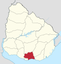
 Villa Felicidad Location in Uruguay | |
| Coordinates: 34°39′0″S 56°14′0″W / 34.65000°S 56.23333°WCoordinates: 34°39′0″S 56°14′0″W / 34.65000°S 56.23333°W | |
| Country |
|
| Department | Canelones Department |
| Population (2011) | |
| • Total | 1,344 |
| Time zone | UTC -3 |
| Postal code | 90300 |
| Dial plan | +598 2 (+7 digits) |
Villa Felicidad is a hamlet (caserío) in the Canelones Department of southern Uruguay.
Location
It is located on Km. 33 of Route 5, about 3 kilometres (1.9 mi) northwest of Progreso.
Population
In 2011 Villa Felicidad had a population of 1,344.[1][2]
| Year | Population |
|---|---|
| 1963 | 376 |
| 1975 | 567 |
| 1985 | 649 |
| 1996 | 791 |
| 2004 | 1,238 |
| 2011 | 1,344 |
Source: Instituto Nacional de Estadística de Uruguay[3]
References
- ↑ "Censos 2011 Cuadros Canelones". INE. 2012. Archived from the original on October 10, 2012. Retrieved 25 August 2012.
- ↑ "Censos 2011 Canelones". INE. 2012. Archived from the original on September 7, 2012. Retrieved 28 August 2012.
- ↑ "1963–1996 Statistics / V" (DOC). Instituto Nacional de Estadística de Uruguay. 2004. Retrieved 13 July 2011.
External links
Capital: Canelones | ||
| Towns and villages |
|  |
| Resorts of the Ciudad de la Costa | ||
| Sights |
| |
This article is issued from Wikipedia - version of the 9/13/2016. The text is available under the Creative Commons Attribution/Share Alike but additional terms may apply for the media files.