Virgie, Kentucky
| Virgie, Kentucky | |
|---|---|
| Census-designated place (CDP) | |
|
Company homes in Virgie in 1940 | |
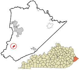 Location in Pike County and the state of Kentucky. | |
| Coordinates: 37°20′06″N 82°34′47″W / 37.33500°N 82.57972°WCoordinates: 37°20′06″N 82°34′47″W / 37.33500°N 82.57972°W | |
| Country | United States |
| State | Kentucky |
| County | Pike |
| Elevation | 902 ft (275 m) |
| Time zone | Eastern (EST) (UTC-5) |
| • Summer (DST) | EDT (UTC-4) |
| ZIP codes | 41572 |
| Area code(s) | 606 |
| GNIS feature ID | 506067 |

Virgie is an Census-designated place (CDP) located along Kentucky Route 1469 in Pike County, Kentucky, United States. Virgie's post office was established as Clintwood on April 3, 1890, with James M. Damron as postmaster. It was later renamed "Virgie" after the daughter of local resident, W.O.B. Ratliff, who was a lawyer and lumber dealer in Pikeville.[1]
Geography
Virgie is located at an elevation of 902 feet (275 m).[2]
Education
Most students residing in Virgie attend:
- Valley Elementary School
- Shelby Valley High School
Notable residents
- Todd May - 1982 Kentucky "Mr. Basketball". Todd May attended Virgie High School while Phillip M. Johnson was the principal there.
References
- ↑ Rennick, Robert M. (1988). "Place Names". Kentucky Place Names. Lexington, Kentucky: The University Press of Kentucky. ISBN 0-8131-0179-4.
- ↑ U.S. Geological Survey Geographic Names Information System: Virgie, Kentucky
External links

This article is issued from Wikipedia - version of the 11/15/2016. The text is available under the Creative Commons Attribution/Share Alike but additional terms may apply for the media files.