Waka, Texas
| Waka, Texas | |
|---|---|
| Unincorporated community | |
 Waka, Texas  Waka, Texas Location within the state of Texas | |
| Coordinates: 36°16′54″N 101°2′52″W / 36.28167°N 101.04778°WCoordinates: 36°16′54″N 101°2′52″W / 36.28167°N 101.04778°W | |
| Country | United States |
| State | Texas |
| County | Ochiltree |
| Elevation | 3,045 ft (928 m) |
| Time zone | Central (CST) (UTC-6) |
| • Summer (DST) | CDT (UTC-5) |
| ZIP codes | 79093 |
| Area code(s) | 806 |
| GNIS feature ID | 1370737 |
Waka is an unincorporated community in western Ochiltree County, Texas, United States. It lies along State Highway 15 southwest of the city of Perryton, the county seat of Ochiltree County.[1] Its elevation is 3,045 feet (928 m).[2] Although Waka is unincorporated, it has a post office, with the ZIP code of 79093;[3] the ZCTA for ZIP code 79093 had a population of 76 at the 2000 census.[4]
The community, initially named Wawaka, was founded by German settlers in 1885, and its post office was opened in 1901. When another community, Burnside, was platted along the Panhandle and Santa Fe Railway 3 miles (5 km) away, Wawaka's residents and its postmaster moved to Burnside; the community was renamed Waka in 1921, two years after the Wawaka residents moved, but the post office remained "Wawaka" for six years.[5]
In 2014, it was announced that, by March 29, the Post Office in Waka would close. Residents were encouraged to use the postal services in Farnsworth or in Perryton.[6]
Climate
According to the Köppen Climate Classification system, Waka has a semi-arid climate, abbreviated "BSk" on climate maps.[7]
References
- ↑ Rand McNally. The Road Atlas '08. Chicago: Rand McNally, 2008, p. 98.
- ↑ U.S. Geological Survey Geographic Names Information System: Waka, Texas
- ↑ Zip Code Lookup
- ↑ "American FactFinder". United States Census Bureau. Retrieved 2008-01-31.
- ↑ Farnsworth, Texas, Handbook of Texas Online, 2008-01-11. Accessed 2008-12-03.
- ↑ Marissa Silver, "Waka Post Office will soon close", KFDA-TV, March 25, 2014. Retrieved 2014-03-26.
- ↑ Climate Summary for Waka, Texas
External links
Municipalities and communities of Ochiltree County, Texas, United States | ||
|---|---|---|
| City | 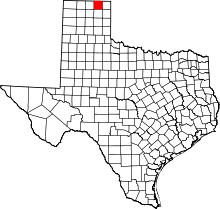 | |
| Town | ||
| Unincorporated communities | ||
| Footnotes | ‡This populated place also has portions in an adjacent county or counties | |