Waldo Township, Marion County, Ohio
| Waldo Township, Marion County, Ohio | |
|---|---|
| Township | |
|
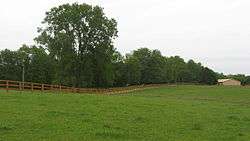
Site of Fort Morrow north of Norton | |
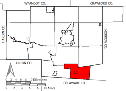 Location of Waldo Township in Marion County | |
| Coordinates: 40°27′52″N 83°4′30″W / 40.46444°N 83.07500°WCoordinates: 40°27′52″N 83°4′30″W / 40.46444°N 83.07500°W | |
| Country | United States |
| State | Ohio |
| County | Marion |
| Area | |
| • Total | 18.9 sq mi (49.0 km2) |
| • Land | 18.9 sq mi (48.9 km2) |
| • Water | 0.0 sq mi (0.0 km2) |
| Elevation[1] | 955 ft (291 m) |
| Population (2000) | |
| • Total | 1,079 |
| • Density | 57.1/sq mi (22.0/km2) |
| Time zone | Eastern (EST) (UTC-5) |
| • Summer (DST) | EDT (UTC-4) |
| ZIP code | 43356 |
| Area code(s) | 740 |
| FIPS code | 39-80514[2] |
| GNIS feature ID | 1086588[1] |
Waldo Township is one of the fifteen townships of Marion County, Ohio, United States. The 2000 census found 1,079 people in the township, 747 of whom lived in the unincorporated portions of the township.[3]
Geography
Located in the southeastern corner of the county, it borders the following townships:
- Richland Township - northeast
- Westfield Township, Morrow County - east
- Marlboro Township, Delaware County - south
- Radnor Township, Delaware County - southwest corner
- Prospect Township - west
- Pleasant Township - northwest
The village of Waldo is located in western Waldo Township.
Name and history
It is the only Waldo Township statewide.[4]
Government
The township is governed by a three-member board of trustees, who are elected in November of odd-numbered years to a four-year term beginning on the following January 1. Two are elected in the year after the presidential election and one is elected in the year before it. There is also an elected township fiscal officer,[5] who serves a four-year term beginning on April 1 of the year after the election, which is held in November of the year before the presidential election. Vacancies in the fiscal officership or on the board of trustees are filled by the remaining trustees.
References
- 1 2 "US Board on Geographic Names". United States Geological Survey. 2007-10-25. Retrieved 2008-01-31.
- ↑ "American FactFinder". United States Census Bureau. Retrieved 2008-01-31.
- ↑ Marion County, Ohio — Population by Places Estimates Ohio State University, 2007. Accessed 15 May 2007.
- ↑ "Detailed map of Ohio" (PDF). United States Census Bureau. 2000. Retrieved 2007-02-16.
- ↑ §503.24, §505.01, and §507.01 of the Ohio Revised Code. Accessed 4/30/2009.
External links
Municipalities and communities of Marion County, Ohio, United States | ||
|---|---|---|
| City |  | |
| Villages | ||
| Townships | ||
| Unincorporated communities | ||
| Ghost town | ||