Wanblee, South Dakota
| Wanblee, South Dakota Waŋblí Hoȟpi | |
|---|---|
| CDP | |
 Location in Jackson County and the state of South Dakota | |
| Coordinates: 43°34′12″N 101°39′34″W / 43.57000°N 101.65944°WCoordinates: 43°34′12″N 101°39′34″W / 43.57000°N 101.65944°W | |
| Country | United States |
| State | South Dakota |
| County | Jackson |
| Area | |
| • Total | 2.2 sq mi (5.8 km2) |
| • Land | 2.2 sq mi (5.8 km2) |
| • Water | 0 sq mi (0 km2) |
| Elevation | 2,638 ft (804 m) |
| Population (2010) | |
| • Total | 725 |
| • Density | 329.5/sq mi (125/km2) |
| Time zone | Mountain (MST) (UTC-7) |
| • Summer (DST) | MDT (UTC-6) |
| ZIP code | 57577 |
| Area code(s) | 605 |
| FIPS code | 46-68580[1] |
| GNIS feature ID | 1267247[2] |
Wanblee (Lakota: Waŋblí Hoȟpi;[3] "Golden Eagle Nest") is a census-designated place on the Pine Ridge Indian Reservation, located in Jackson County, South Dakota, United States. The population was 725 at the 2010 census, and virtually all of whom are members of the Oglala band of Lakota Sioux. Wanbli is the Lakota word for eagle, and the town was named for its proximity to Wanbli hohpi paha (Eagle Nest Butte).[4] Wanblee is a few miles directly northeast of the North American continental pole of inaccessibility.
Geography
Wanblee is located at 43°34′12″N 101°39′34″W / 43.57000°N 101.65944°W (43.569908, -101.659567).[5]
According to the United States Census Bureau, the CDP has a total area of 2.2 square miles (5.7 km2), all land.
Wanblee has been assigned the ZIP code 57577.
Demographics

As of the census[1] of 2000, there were 641 people, 132 households, and 107 families residing in the CDP. The population density was 287.0 people per square mile (111.0/km²). There were 144 housing units at an average density of 64.5/sq mi (24.9/km²). The racial makeup of Wanblee was 97.19% Native American, 2.34% White, and 0.47% from two or more races.
There were 132 households out of which 50.8% had children under the age of 18 living with them, 32.6% were married couples living together, 35.6% had a female householder with no husband present, and 18.9% were non-families. 18.2% of all households were made up of individuals and 6.8% had someone living alone who was 65 years of age or older. The average household size was 4.86 and the average family size was 5.35.
In the CDP the population was spread out with 47.6% under the age of 18, 12.5% from 18 to 24, 21.8% from 25 to 44, 13.4% from 45 to 64, and 4.7% who were 65 years of age or older. The median age was 19 years. For every 100 females there were 96.6 males. For every 100 females age 18 and over, there were 96.5 males.
About 68.9% of families and 72.3% of the population were below the poverty line, including 72.9% of those under age 18 and 86.2% of those age 65 or over. The per capita income in Wanblee was $4,584. The median income for a household was $14,286, and the median income for a family was $14,844. Males had a median income of $18,750 versus $17,917 for females.
References
- 1 2 "American FactFinder". United States Census Bureau. Retrieved 2008-01-31.
- ↑ "US Board on Geographic Names". United States Geological Survey. 2007-10-25. Retrieved 2008-01-31.
- ↑ Ullrich, Jan F. (2011). New Lakota Dictionary (2nd ed.). Bloomington, IN: Lakota Language Consortium. p. 1140. ISBN 978-0-9761082-9-0.
- ↑ Federal Writers' Project (1940). South Dakota place-names, v.1-3. University of South Dakota. p. 66.
- ↑ "US Gazetteer files: 2010, 2000, and 1990". United States Census Bureau. 2011-02-12. Retrieved 2011-04-23.
Municipalities and communities of Jackson County, South Dakota, United States | ||
|---|---|---|
| City | 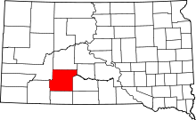 | |
| Towns | ||
| CDP | ||
| Unincorporated communities | ||
| Indian reservation | ||
| Ghost town | ||
| Footnotes | ‡This populated place also has portions in an adjacent county or counties | |