Warden, Quebec
| Warden | |
|---|---|
| Village municipality | |
|
City limit sign in Warden. | |
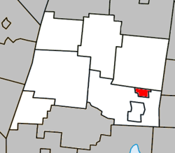 Location within La Haute-Yamaska RCM. | |
 Warden Location in southern Quebec. | |
| Coordinates: 45°23′N 72°30′W / 45.383°N 72.500°WCoordinates: 45°23′N 72°30′W / 45.383°N 72.500°W[1] | |
| Country |
|
| Province |
|
| Region | Montérégie |
| RCM | La Haute-Yamaska |
| Constituted | March 31, 1916 |
| Government[2][3] | |
| • Mayor | Philip Tétrault |
| • Federal riding | Shefford |
| • Prov. riding | Brome-Missisquoi |
| Area[2][4] | |
| • Total | 5.60 km2 (2.16 sq mi) |
| • Land | 5.53 km2 (2.14 sq mi) |
| Population (2011)[4] | |
| • Total | 358 |
| • Density | 64.7/km2 (168/sq mi) |
| • Pop 2006-2011 |
|
| • Dwellings | 149 |
| Time zone | EST (UTC−5) |
| • Summer (DST) | EDT (UTC−4) |
| Postal code(s) | J0E 2M0 |
| Area code(s) | 450 and 579 |
| Highways |
|

Warden is a village located in the province of Quebec, part of La Haute-Yamaska Regional County Municipality in the administrative area of Montérégie. The population as of the Canada 2011 Census was 358. The village is almost completely encircled by the municipality of Shefford with Saint-Joachim-de-Shefford, as its only other border, to the north.
Demographics
Population
Population trend:[5]
| Census | Population | Change (%) |
|---|---|---|
| 2011 | 358 | |
| 2006 | 346 | |
| 2001 | 333 | |
| 1996 | 330 | |
| 1991 | 340 | N/A |
Language
Mother tongue language (2006)[6]
| Language | Population | Pct (%) |
|---|---|---|
| French only | 265 | 73.61% |
| English only | 70 | 19.44% |
| Both English and French | 15 | 4.17% |
| Other languages | 10 | 2.78% |
See also
References
- ↑ Reference number 66636 of the Commission de toponymie du Québec (French)
- 1 2 Ministère des Affaires municipales, des Régions et de l'Occupation du territoire: Warden
- ↑ Parliament of Canada Federal Riding History: SHEFFORD (Quebec)
- 1 2 2011 Statistics Canada Census Profile: Warden, Quebec
- ↑ Statistics Canada: 1996, 2001, 2006, 2011 census
- ↑ 2006 Statistics Canada Community Profile: Warden, Quebec
 |
Saint-Joachim-de-Shefford | | ||
| Shefford | |
Shefford | ||
| ||||
| | ||||
| Shefford |
| Cities | |
|---|---|
| Municipalities | |
| Townships | |
| Villages | |
| |
This article is issued from Wikipedia - version of the 7/18/2015. The text is available under the Creative Commons Attribution/Share Alike but additional terms may apply for the media files.